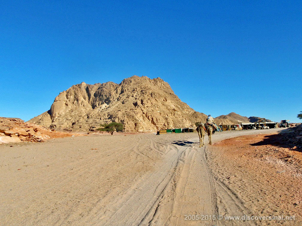
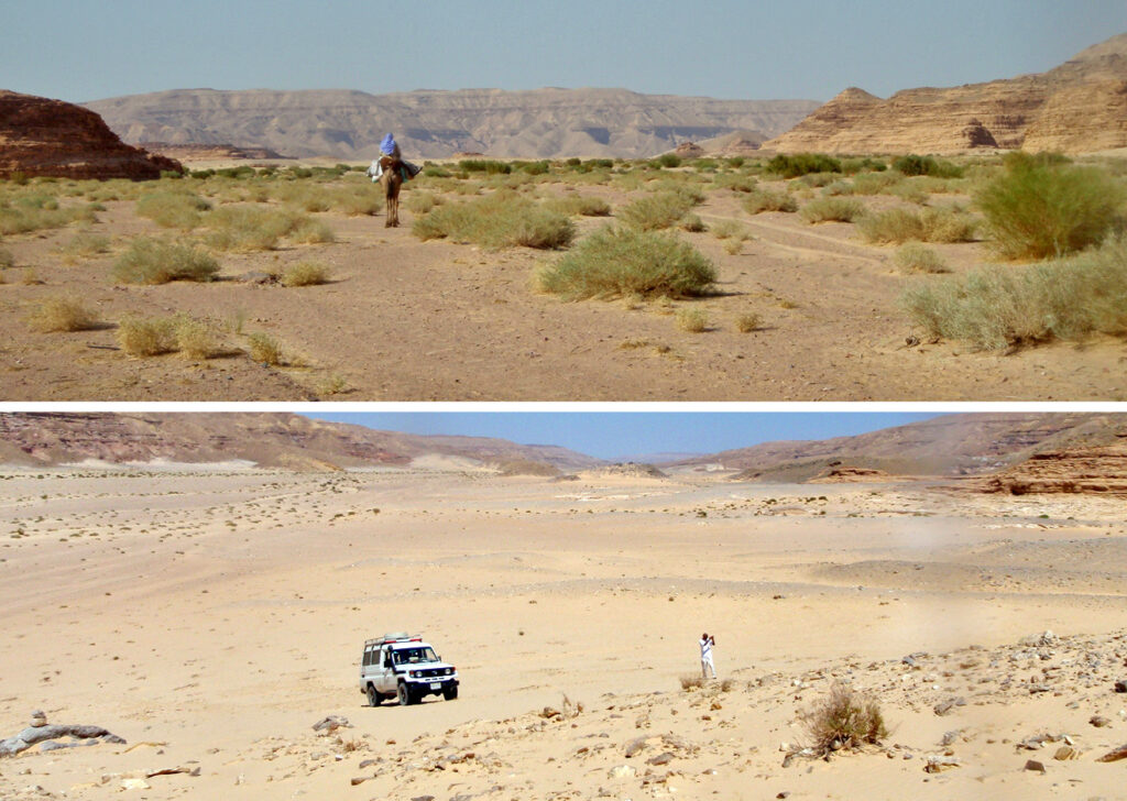
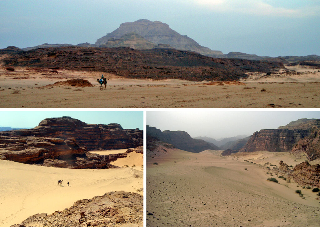
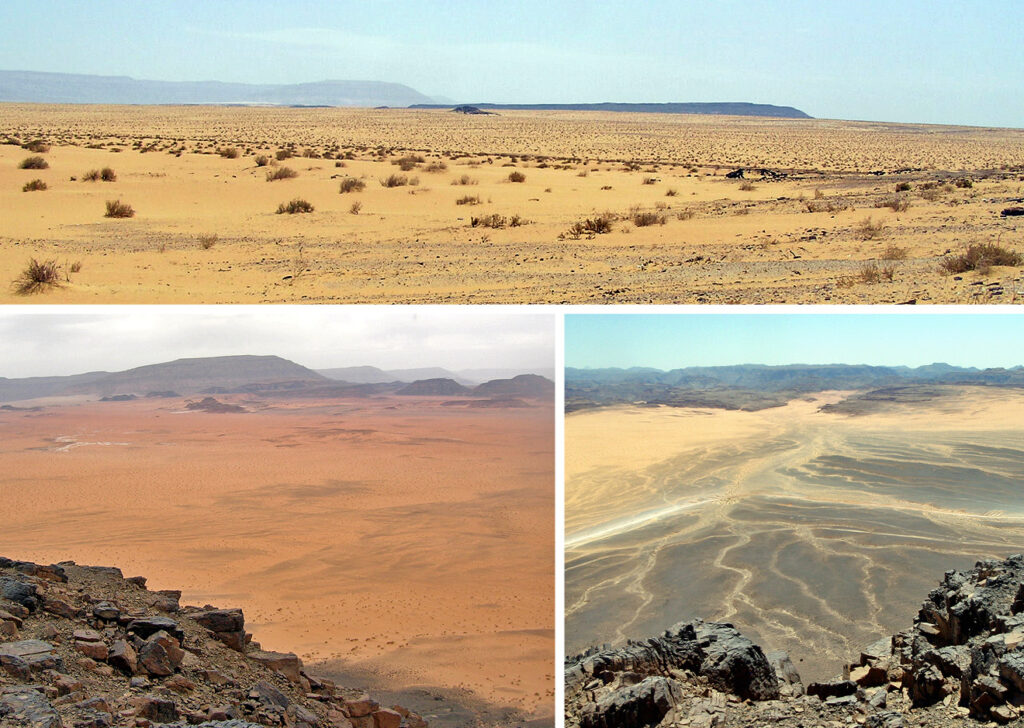
The desert of Sinai is remarkably diverse and has many different faces. There are vast open plains and high sand dunes, surreal sandstone hills and wind-carved rock formations, flat-topped ranges and plateaus offering dramatic views, rugged mountains, and a maze of long winding wadis. There are also green oases, hidden canyons, and a number of sites of archaeological interest dating from Byzantine, Pharaonic, Nabataean, and even earlier times.
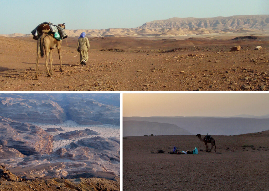
Most of the southern tip of the peninsula is mountainous, while the centre is dominated by the rugged wilderness of the Tih Plateau. Between the two lies a broad sandy desert belt stretching across the peninsula from the Gulf of Suez to the Gulf of Aqaba. This belt can be divided into three safari regions that overlap in the middle around Jebel Dalal, the southernmost head of the Tih Plateau, but otherwise correspond more or less to tribal territories, each with its own distinct character, landscapes, and attractions.
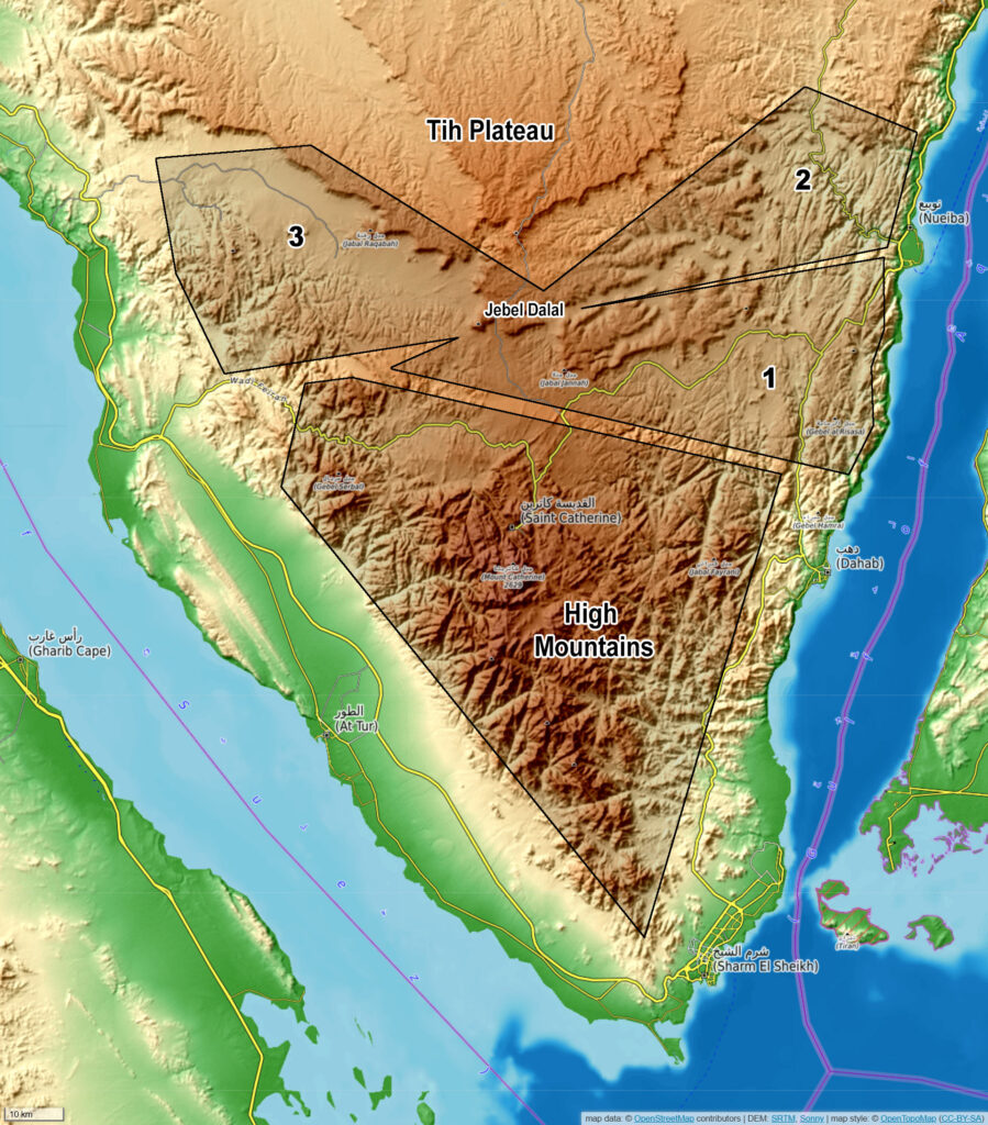
Desert regions: 1. Muzeina Region; 2. Tarabin Region; 3. Aliqat Region.
Muzeina Region
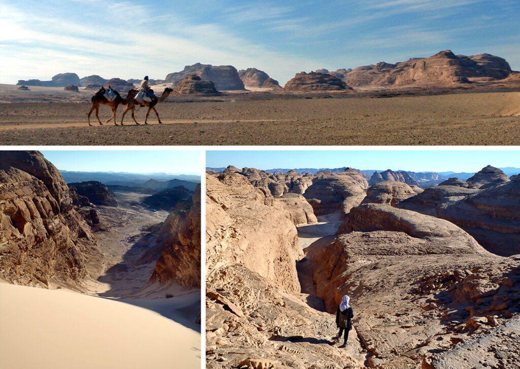
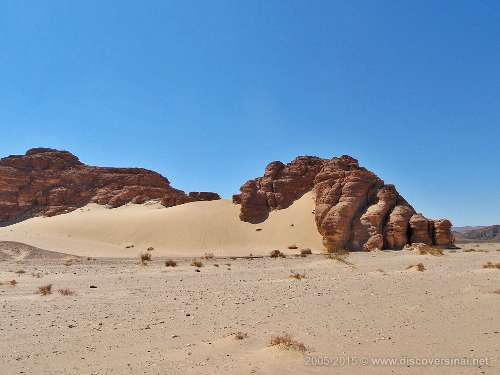
This is perhaps the most spectacular sandy desert landscape in Sinai, and certainly one of the most varied. It features canyons, sandy plains, rock formations and surreal rock hills, beautiful green oases, and flat-topped mountains. The region stretches from the plains below Jebel Dalal (Elu el Ajramiya) to the southern outskirts of Nuweiba and the Ras Abu Galum Protectorate north of Dahab.
Ein Hodra oasis
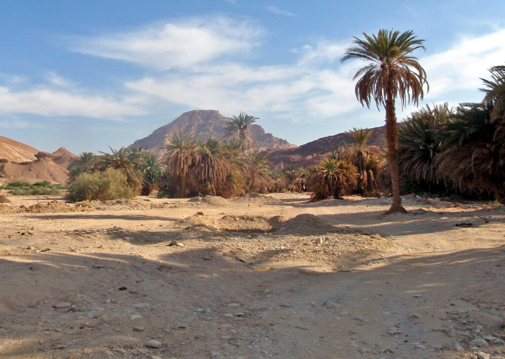
Ein Khudra, meaning Green Spring, is a picturesque oasis with gardens and date palms, encircled by steep mountain ranges and vertical cliffs. It is very easy to reach from the main road. There are springs here – one of them is in a small cave, another overflowing from a fountain – which sustain a number of gardens. There are also ruins of archeological interest in the area.
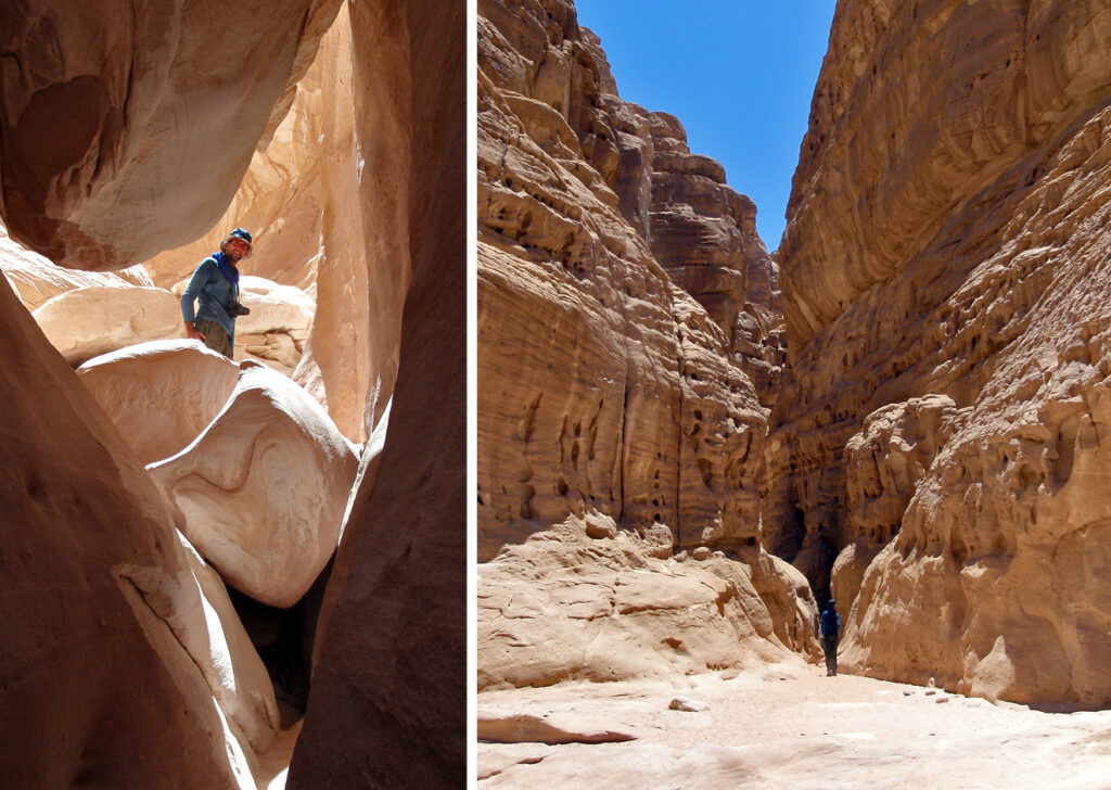
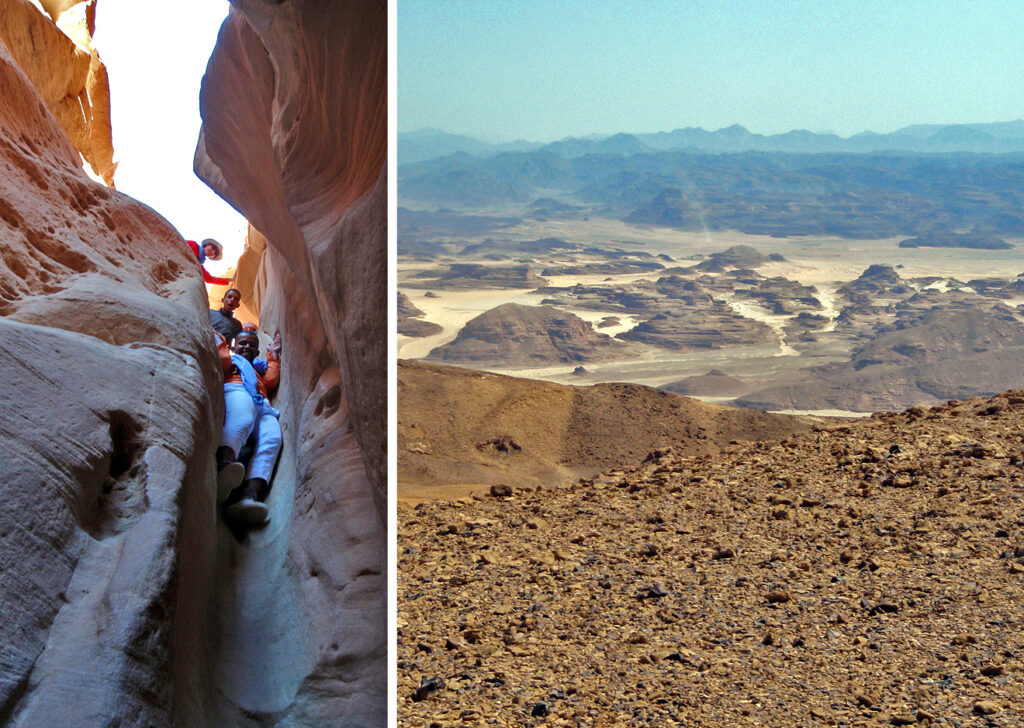
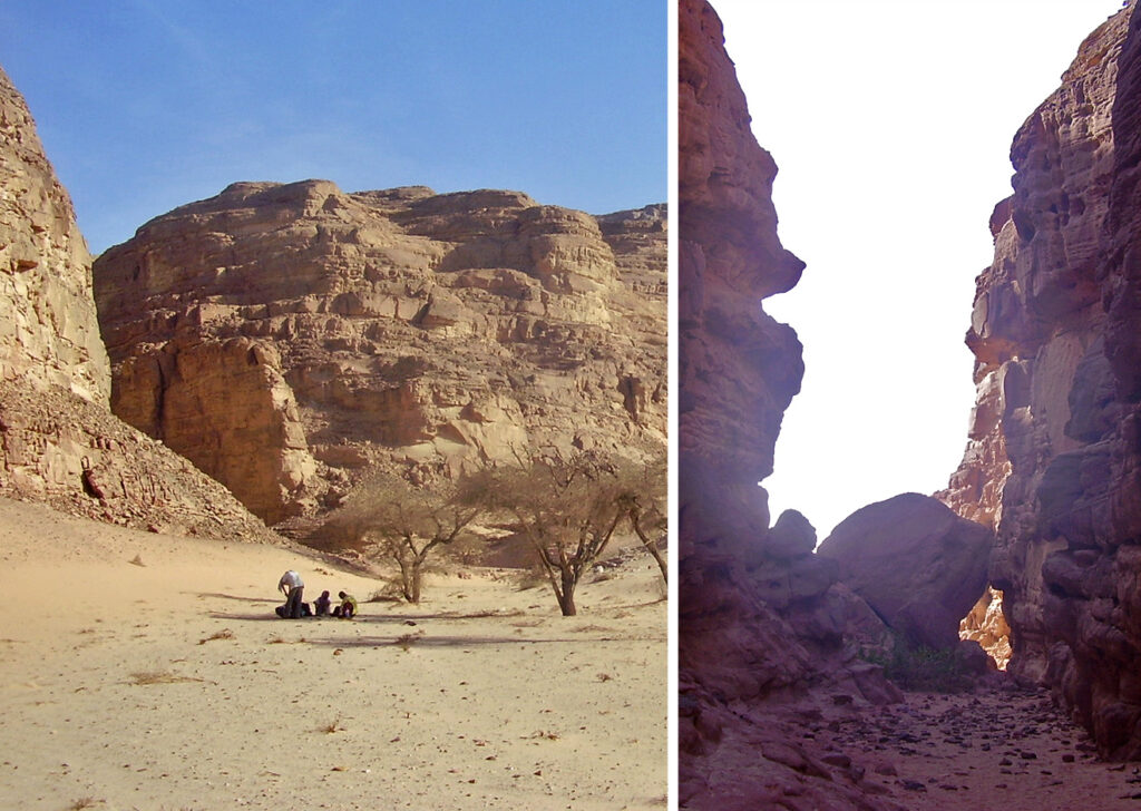
The White Canyon
Starting as a crack at the edge of a sand plateau, it is a narrow sandstone canyon, opening to a wider wadi and leading to the oasis of Ein Khudra. A little climbing is involved at places.
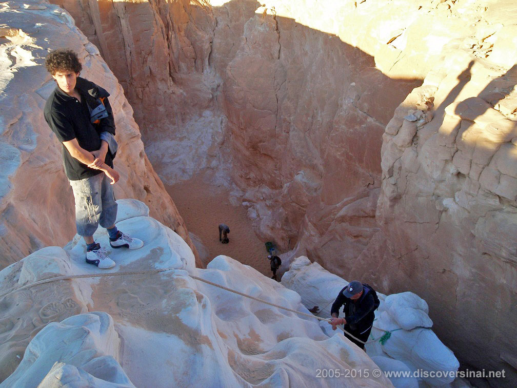
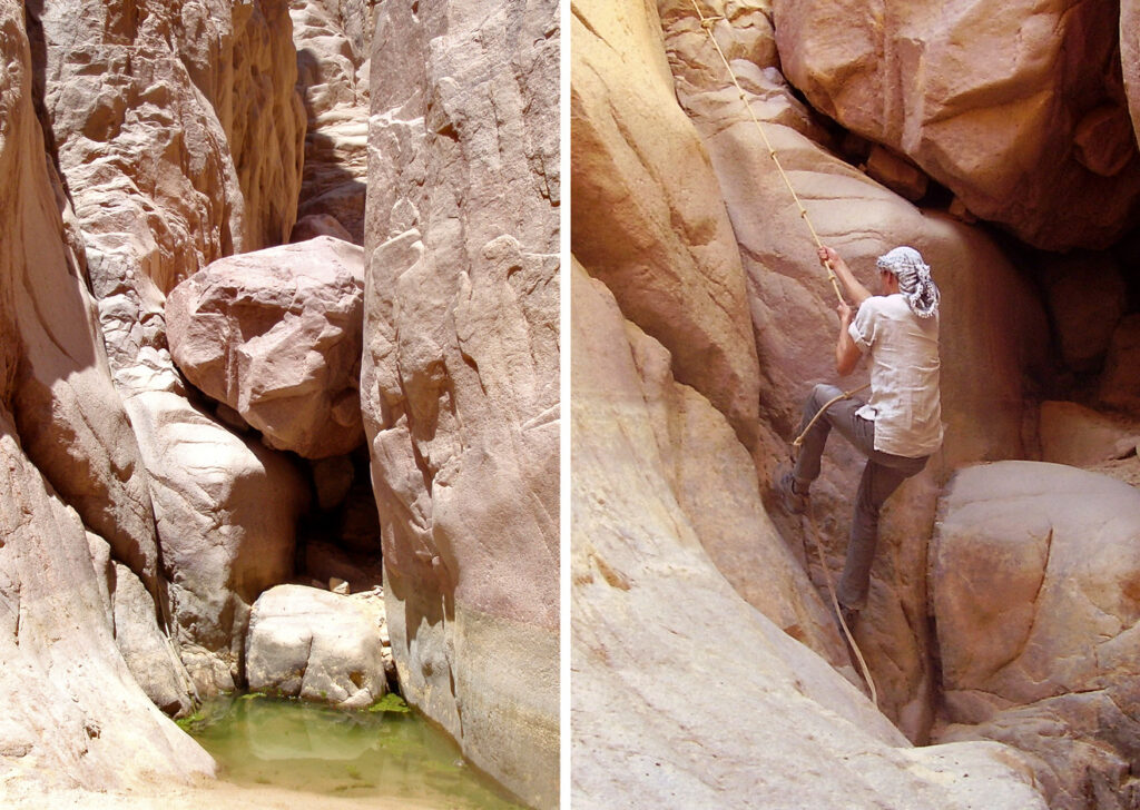
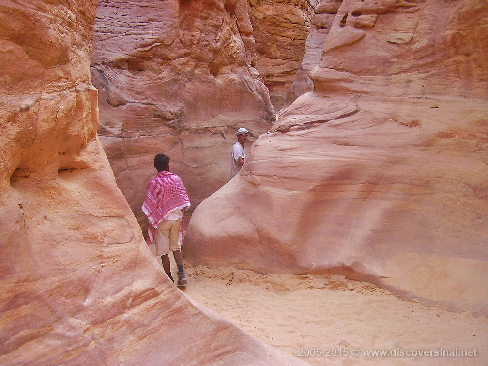
Closed Canyon
Located just off Wadi Khudra in a secluded sandy basin, the Closed Canyon is usually approached by 4×4 via Ein Khudra, Ras Ghazala, Jebel Mileihis or Ein Furtaga. On foot you could also come via Wadi Rum, or from the Tarabin areas in the north. The Closed Canyon is not the most famous sight, but it is impressive as it runs extremely narrowly between very high walls. The beginning of the canyon is still relatively wide, but later it gets so narrow people can just about pass through. The canyon then widens up a bit, but as the name suggests is closed at the very end by unscalable vertical walls.
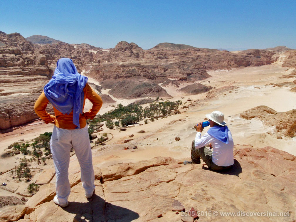
Jebel Mileihis
Jebel Mileihis is a flat sandstone mountain towering over the desert, with views as far as the sea at Nuweiba. There are springs with date palms, Moyat Mileihis, at its foot in a tranquil setting. Wadi Disco, named after the Bedouin parties held here, is a small settlement close to the mountain, connected to Canyon Salama (Red Canyon).
Nawamis Site
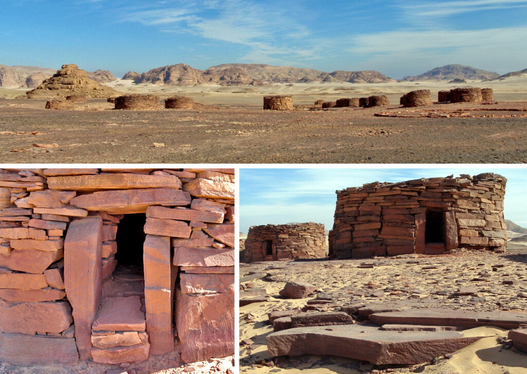
Mysterious prehistoric stone buildings, dating back to the Copper Stone Age (4000-3150 BC), which are only found in South Sinai, in several areas. They are believed to be ritual burial chambers, always located at elevated points and facing west. This is the biggest and best-preserved site, but there are many similar ruins all across South Sinai.
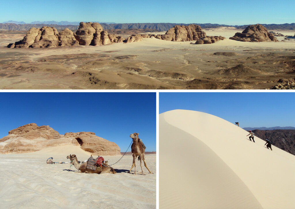
Jebel Matamir
A group of elongated sandstone hills, rising from a sandy plain and separated by gullies. There are steep sand dunes running from some parts of the hills. From the peaks of Jebel Matamir there are far reaching views of the sand desert and distant high mountain ranges.
Jebel Barqa (Jebel Makharum) and Haduda sand dune
The popular sandstone formation of Jebel Makharum, with a hole cutting through it, is only one of the many curious rock formations and hills of the sandstone range called Jebel Barqa. There are also many small caves, sand dunes and rock formations offering stunning views from the top. The high sand plateau around Jebel Barqa suddenly comes to an end at Haduda sand dune, where it drops steeply about 150 meters to a rocky wadi running towards the coast. Magnificent views, but also a place to have fun and get sand all over you.
Dune of Safra
The rock formation and high sand dune are a short distance away from a well known as Bier Safra, at the crossing of different major routes. It is connected to the Jabal Barqa area and also to Wadi Arada and the canyon there.
Arada Canyon (Double Canyon)
There are actually two canyons, branching off from the same entrance and connected via a small plateau, forming a circuit. It involves some climbing and little help might be needed at tricky parts. Its entrance is located in a secluded sandy stretch of a gully.
Guna Plateau
A long, flat mountain range between two main wadis from which gullies descend to all directions. From the rim of the plateau there are stunning views of the surrounding sand desert, dotted with sandstone outcrops and framed by distant rugged ranges, including Mt. Katherina. Several canyons are located at the base of the Guna Plateau.
Tarabin Region
The heartland of this southern Tarabin tribal territory lies west of Nuweiba, and it is home to the region’s – and perhaps Sinai’s – most famous desert attraction, the Colored Canyon. Further west, the region includes Wadi Zalaqa, which separates the Guna Plateau from the Tih Plateau. It is a major thoroughfare between the coast and the interior, ending at the plains below Jebel Dalal (Joofa).
Wishwashi Canyon
Located a short distance from the laid-back beaches of Ras Shaitan, between Nuweiba and Taba, the Wishwashi Canyon is a very pretty place when it’s full of water. It is just off Wadi Milha, the route to the Coloured Canyon. Wishwashi Canyon is usually visited as part of that trek, but could be done separately. A little scrambling is involved to reach the point where the canyon is cut off, and water might be present in a pool.
Colored Canyon
The Colored Canyon is the best known of all the canyons in the Sinai. It runs between steep walls displaying a palette of incredible colors and rock formations, starting off from a plateau and ending at a sandy wadi. Coming from Wishwashi Canyon, this sandy wadi is where you enter. The walking trail continues further north, towards Bier Biriya and the Rainbow Canyon.
Ein Furtaqa
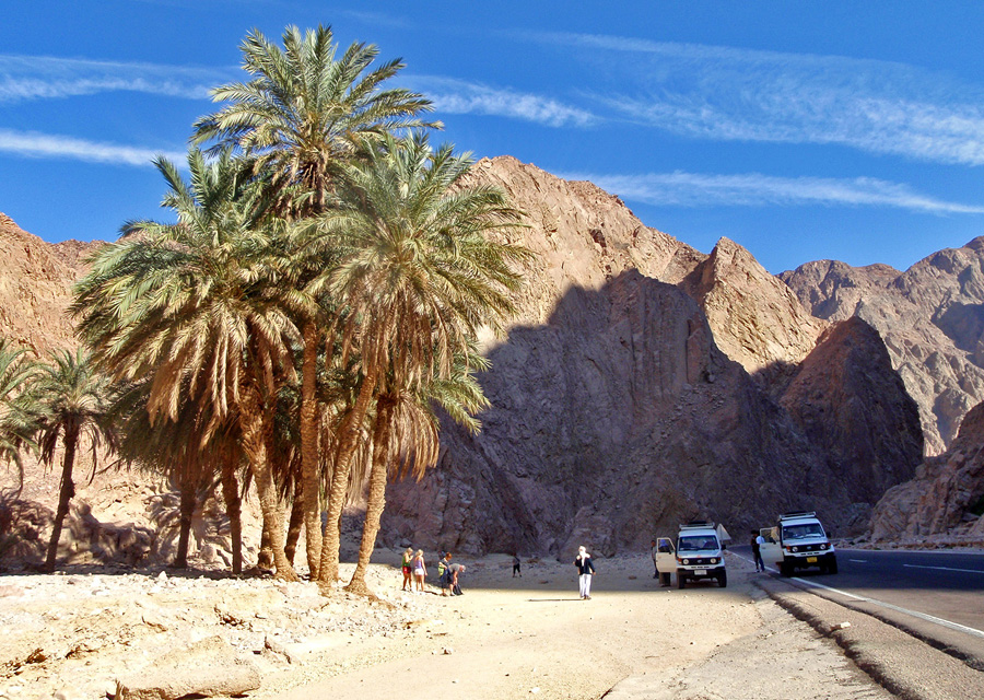
Ein Furtaqa is a little oasis in Wadi Watir, along the 4×4 route between the Colored Canyon and Wadi Ghazala (Ein Hodra). It is also on the asphalt road, as Wadi Watir is a major throughfare connecting mainland Egypt and the port in Nuweiba.
Rainbow Canyon
Colourful canyon, with its entrance opening from a secluded sandy basin encircled by jagged rock faces. You can only reach the area on foot, either coming from Bier Biriya, a well with date palms, or from Wadi Watir via Hlel el Waar. It’s a pretty place, worth a visit if you are walking from the Coloured Canyon to Jebel Berqa, but to make a detour just to see it alone probably not.
Ein Umm Ahmed oasis
One of the main Tarabin oases in South Sinai, in the sand belt running from coast to coast under the Tih plateau along a main dirt road. There are many date palms and several plantations and the place has a remote, wild frontier feel. There are many Nawamis buildings in the area and on foot or camel the oasis is connected to a number of beautiful locations, such as Jebel Berqa.
Wadi Zalaqa
Long and wide Wadi Zalaqa, running between the walls of long ranges, is part of the sandy belt below the Tih Plateau that connects the peninsula coast to coast. It starts at Wadi Zaranik under Jebel Dalal (near Joofa) in the centre of South Sinai, and ends at the oasis of Ein Umm Ahmed in the east. Jebel Berqa, the most impressive mountain of this region, is just off Wadi Zalaqa shortly before Ein Umm Ahmed. You find many Nawamis buildings along the way. Wadi Zalaqa is also the place where the annual intertribal camel race is held.
Jebel Berqa and El Breqa
An impressive round sandstone mountain rising from the sandy plains and lower hills. The way to the top starts in one of the narrow canyons at its base, but the climb is difficult and dangerous towards the end. The views from the saddle at the top of the canyon, which can be reached fairly easily, also offer nice views to two directions. El Breqa is a high sand dune piled up between the walls of a long wadi, separated from Jebel Berqa by a little pass over a rocky hill.
Aliqat Region
Several tribes have territories within this region, but the largest part with the main attractions belongs to the Aliqat. They are also the dominant force in tourism, although they do not have the exclusive right to operate in the region. Other tribes present include the Qararsha, Hamada, Suwalha, and Badara. The region offers a variety of historic sites and a dramatic sandy plain below the long escarpment of the Tih Plateau, which can be ascended at several points. It covers the area between Wadi Mukattab (north of Wadi Feiran), Serabit el Khadem (east of Abu Zenima), and the plains below Jebel Dalal (Wadi Gharaba).
Wadi Mukattab: The Valley of Inscriptions
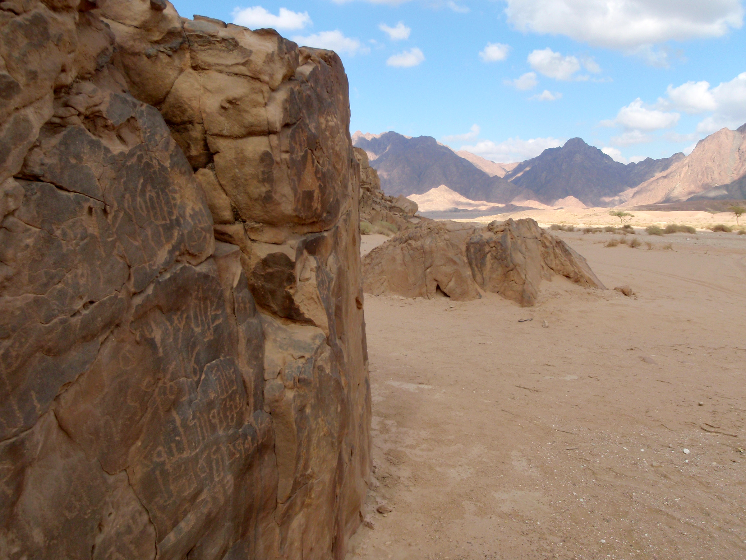
Historic sight in beautiful natural setting – Wadi Mukattab, the valley ofthe inscriptions, is in an open sandy area along the off-road route to Serabit el Khadem from the Wadi Feiran asphalt road. There are ancient scripts on the rock faces for several hundred meters.
Wadi Maghara: turquoise mines
Turquoise was mined at Wadi Maghara from the time of the Pharaohs. There are several caves and one Pharaonic carving. The entrance to the narrow wadi is at the shrine of Sheikh Suliman. The area is close to Wadi Mukattab.
Serabit el Khadem: Temple of Hathor
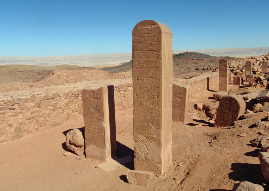
North of Wadi Maghara lies Serabit el Khadim, the most important pharaonic site in the Sinai. It is located where the sandy desert belt below the Tih plateau meets the rocky ranges to the south. The temple of Hathor is on the top of a flat range, offering a magnificent backdrop of the desert to the archaeological site.
Wadi Gharandal
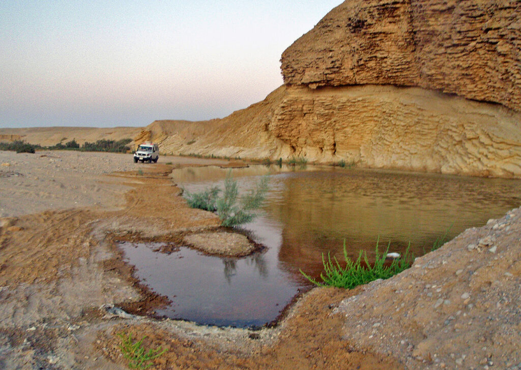
Another way to Serabit el Khadim, coming from the Gulf of Suez coast, is Wadi Gharandal. It is a long wadi running below the Tih Plateau, and its mouth near the coast, Seil Gharandal, is especially pretty. Water runs along the surface and there are ponds, gardens, date palms and lush vegetation. Going to Serabit el Khadim, this route is more scenic than the one from Abu Zenima – the two actually join at one point in the sand desert – but it is also a major industrial road with many trucks and several open mines along the way.
Ramlat Hmeyer and Jebel Hmeyer
Ramlat Hmeyer, the “Red Sand”, is a vast desert plain between the dark Serabit ranges and the Tih Plateau. It comes to an end at Jebel Hmeyer which looks like a hill from one side – there is a dramatic drop on the other side though. A 4×4 vehicle can easily drive up to the flat top, there is a good track. Below there is another plain, with curious patterns of red and black sand washed together by occasional rains.
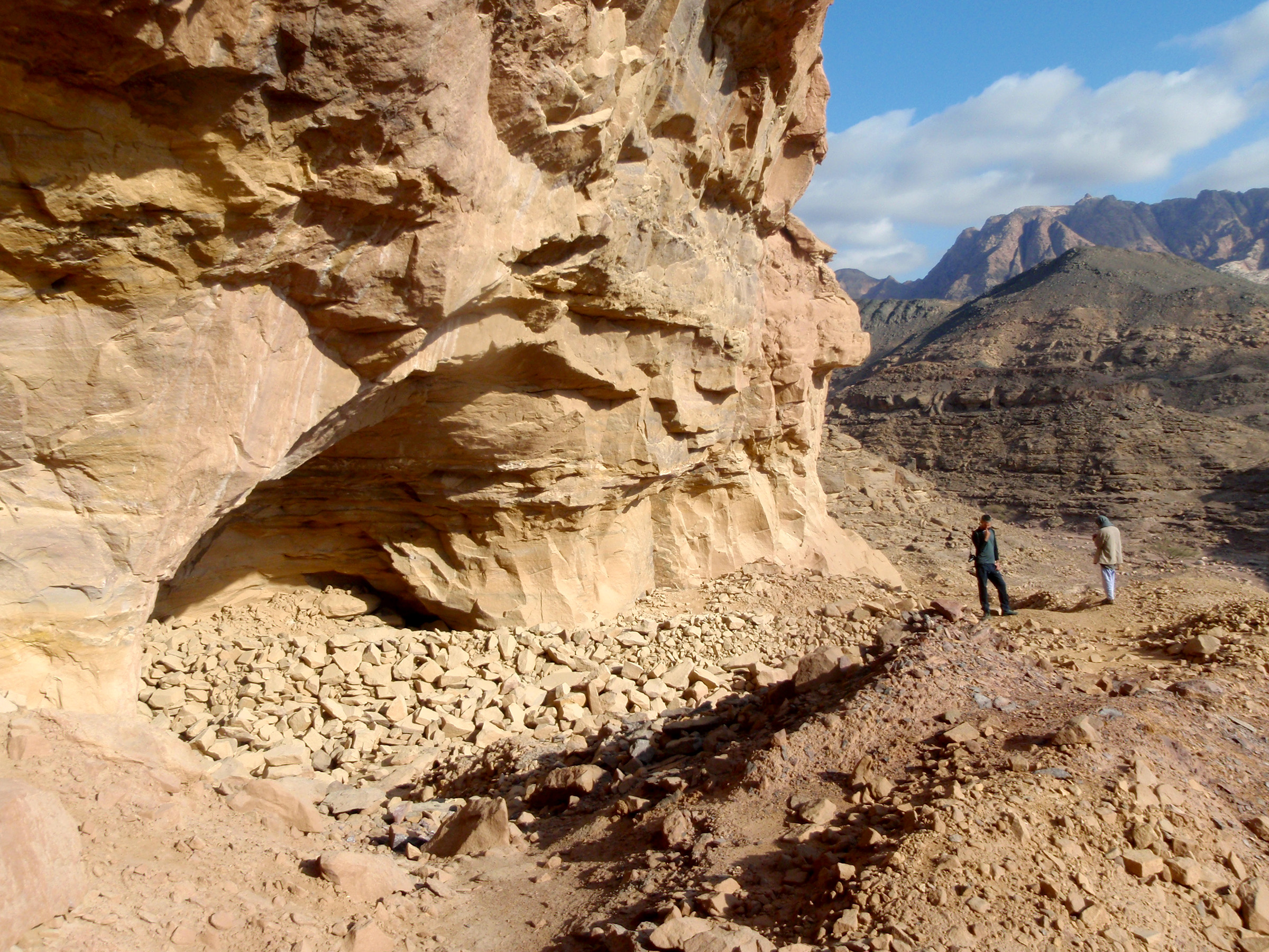
Forest of Pillars (Jebel Fuqa) & Jebel Raqaba
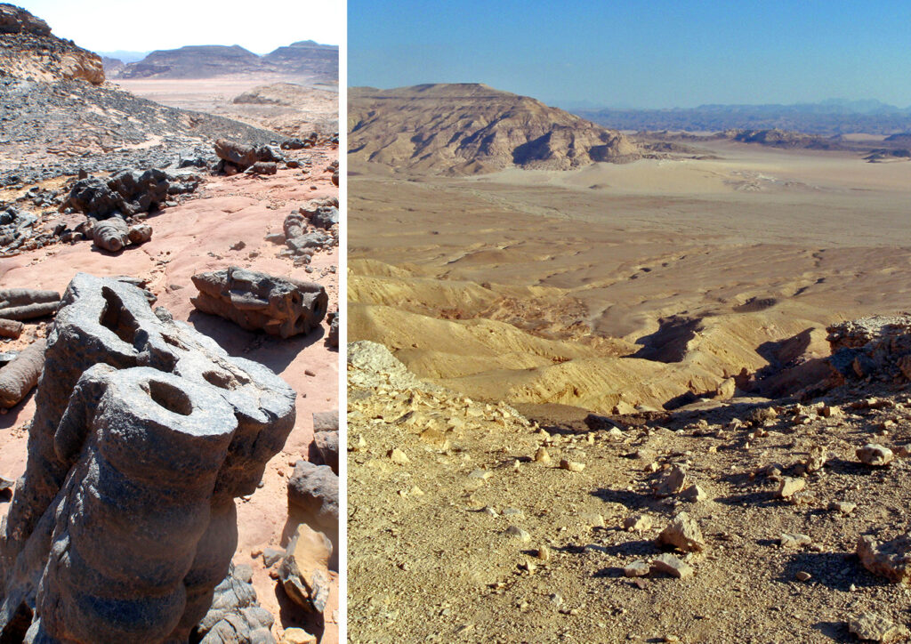
The Forest of Pillars is an unusual geological rock formation at the foot of the Tih Plateau. The area is often known as Jebel Fuqa, which is actually a rocky hill nearby. Above the Forest of Pillars is Jebel Raqaba, one of the heads of Jebel el Tih, which you can climb from the nearby settlement of Warsa. The Forest of Pillars has been badly damaged by tourism, but it is still well worth a visit.
The Tih Plateau
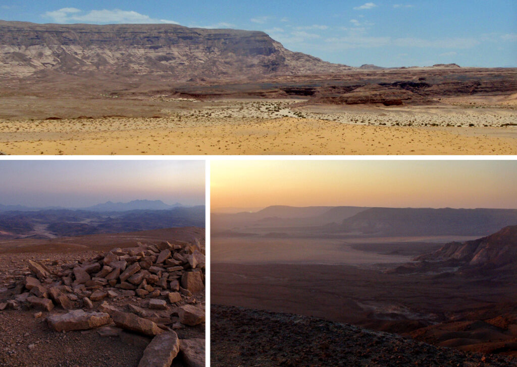
The center of the Sinai is a flat desert highland known as the Tih Plateau. It comes to a sudden and deep drop at a sandy desert belt that cuts across the peninsula coast to coast. Looking at the Tih from the south, it looks as a massive and long rock wall with several protruding heads. You can ascend the plateau at certain points, some on foot only (for example Jebel Raqaba), others also by camel and 4×4 (such as Jebel Dalal). The ridge of the Tih Plateau is roughly the border between North and South Sinai according to tribal traditions.
ATTRACTIONS: Red Sea Coast > St Catherine & Mt Sinai > The High Mountain Region > The Desert > North Sinai