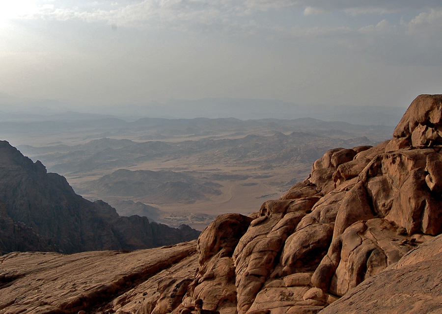
Strictly speaking, the Sinai High Mountain Region, as marked on the locally available hiking maps, is the area around the town of Saint Catherine, from Sheikh Awad in the north to Mount Katherine in the south, and from Bab el Donya in the west to Jebel el Deir in the east. However, the whole southern tip of the South Sinai interior is a mountainous region and is sometimes referred to as the Sinai high mountains. The second-tallest mountain, Jebel Umm Shaumar, and the tallest mountain to climb, Jebel Serbal, are both located within this larger area, along with several other mighty peaks. For easier distinction, we call it the “remote high mountains”. The Sinai High Mountain Region proper, sometimes called the central high mountains, falls within the territory of the Jabaleya Bedouin tribe, and only they are allowed to organize hikes and treks here. In the remote high mountains, other tribes are also present and involved in tourism: the Ulad Said and the Muzeina.
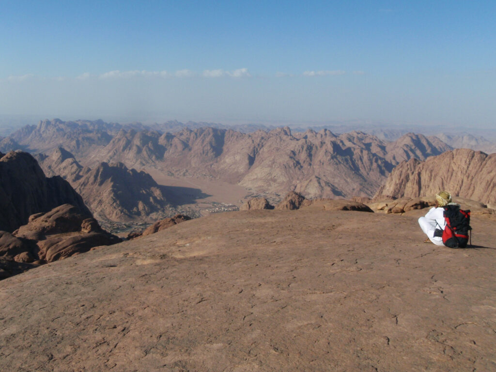
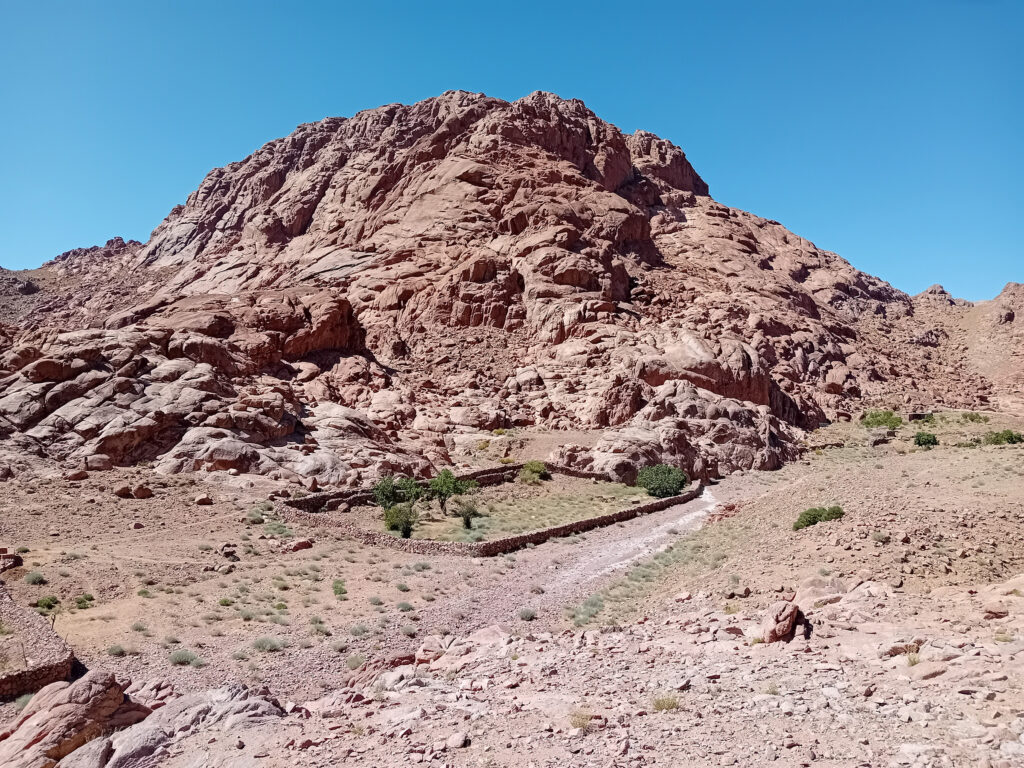
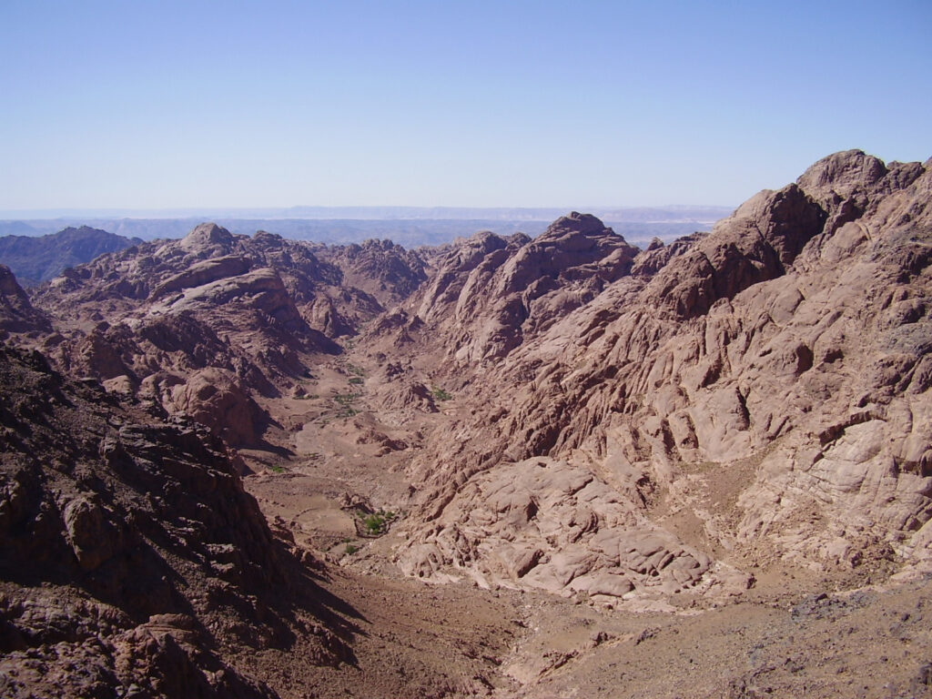
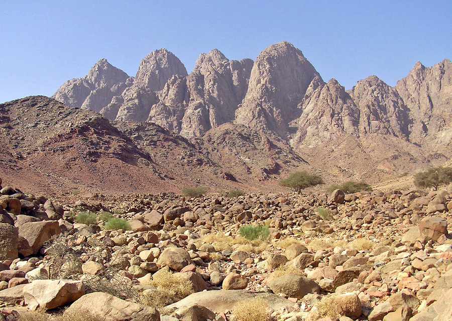
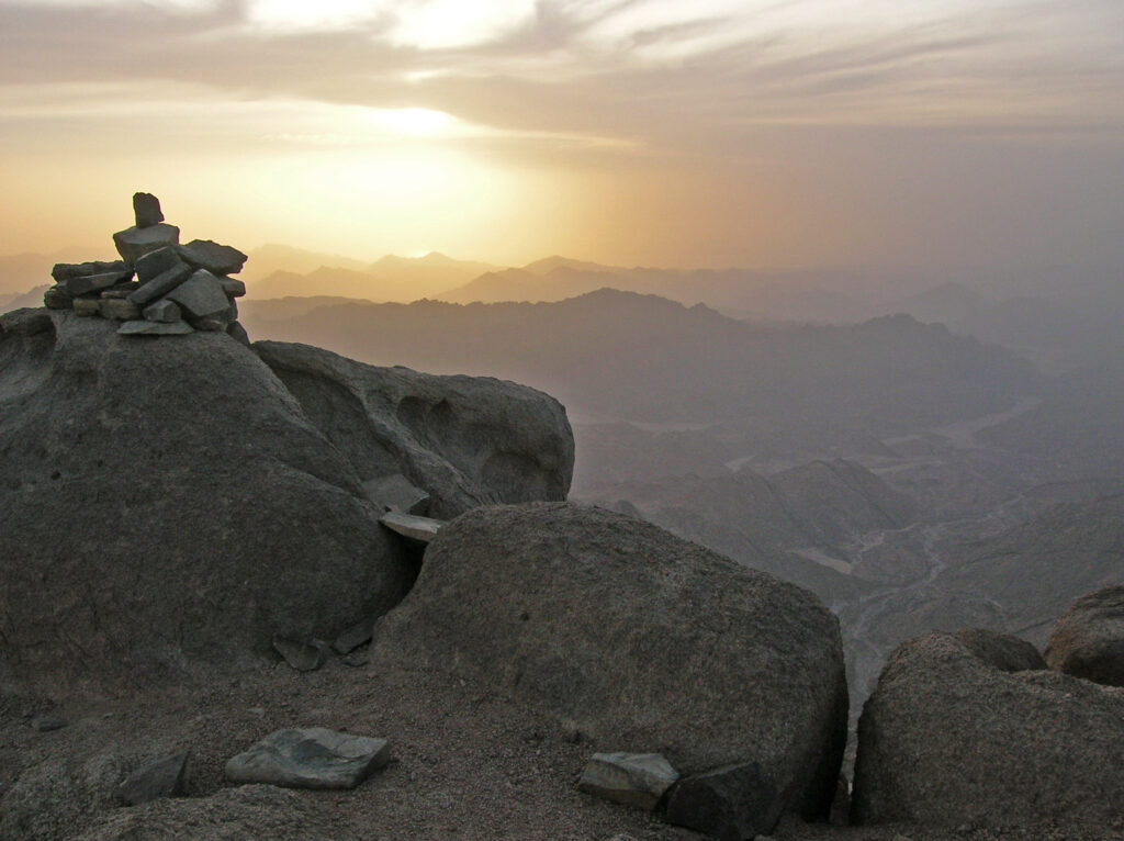
The town of Saint Catherine lies at about 1,600–1,700 metres above sea level (depending on which end of town you look at), and many of the surrounding mountains are above 2,000 metres, with Mt. Katherine being the tallest at 2,642 metres. Because of its elevation, the area receives more precipitation than the rest of the Sinai Peninsula and is relatively wet. It is still a desert ecosystem, but there are hundreds of Bedouin orchards and several natural water pools. The area is mostly granite, with characteristic smooth red domes and hidden basins, although about 20% consists of newer volcanic rock, black in colour and covered with broken, loose gravel. The two rock types often combine, with half a mountain belonging to one type and the other half to the other. The whole region stands above the rest of the peninsula, and from its perimeter you can see down to smaller ranges and plains, and at some points to the sea. The climate is cooler than that of the rest of Egypt, making possible a unique flora and a wide variety of cultivated fruit species. In winter there may be snow, and temperatures can drop far below zero at higher elevations, although the days are usually still pleasantly warm. Spring and autumn are the best times to visit, but the Saint Catherine area is a year-round destination: a bit hot during the day in summer, a bit chilly at night in winter, but manageable.
Sinai High Mountain Region Hiking Map
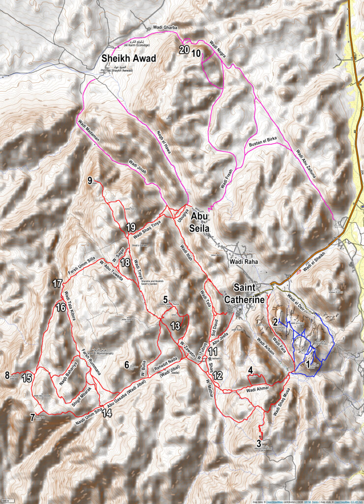
Mountains: 1. Mount Sinai (Jebel Musa); 2. Ras Safsafa; 3. Mount Katherine (Jebel Katrin); 4. Jebel l’Ahamar; 5. Jebel Abbas Basha; 6. Jebel Umm Loz; 7. Ras Abu Alda & Masb Abu Gharun; 8. Bab el Donya (Jebel el Bab); 9. Jebel Naja; 10. Jebel el Banat.
Main sites: 11. Ein Shkaya (spring); 12. Kharaza (pool) & Canyon; 13. Farsh Abu Mahashur (hidden basin); 14. Abu Ghasaba (ruined church, spring); 15. Ein Najila (ruined church, spring); 16. Sid Abu Hbeq (pools) & Canyon Beri; 17. Galt el Azraq (pool); 18. Ein Sagar (spring); 19. Kharazet el Shaq (pools, cascades); 20. Sid al Nogra (pools, waterfall).
Blue Trail: Mount Sinai-Ras Safsafa range (see St Catherine & Mt Sinai); Red Trail: main hiking area / Wadi Jibal; Purple Trail: secondary hiking area / Wadi Freah.
Mountains & Peaks
Fowllowing are all the main peaks in the Sinai High Mountain Region, starting with the highest, and following the order of a usual big mountain hiking circuit. Mount Sinai and Ras Safsafa are also mighty peaks in this region, but dealt with separately in the St Catherine & Mt Sinai page of the website.
Mt. Katherina
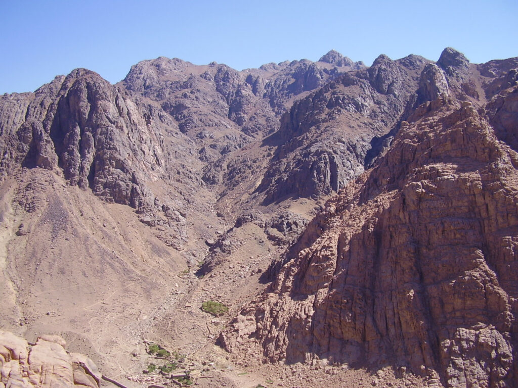
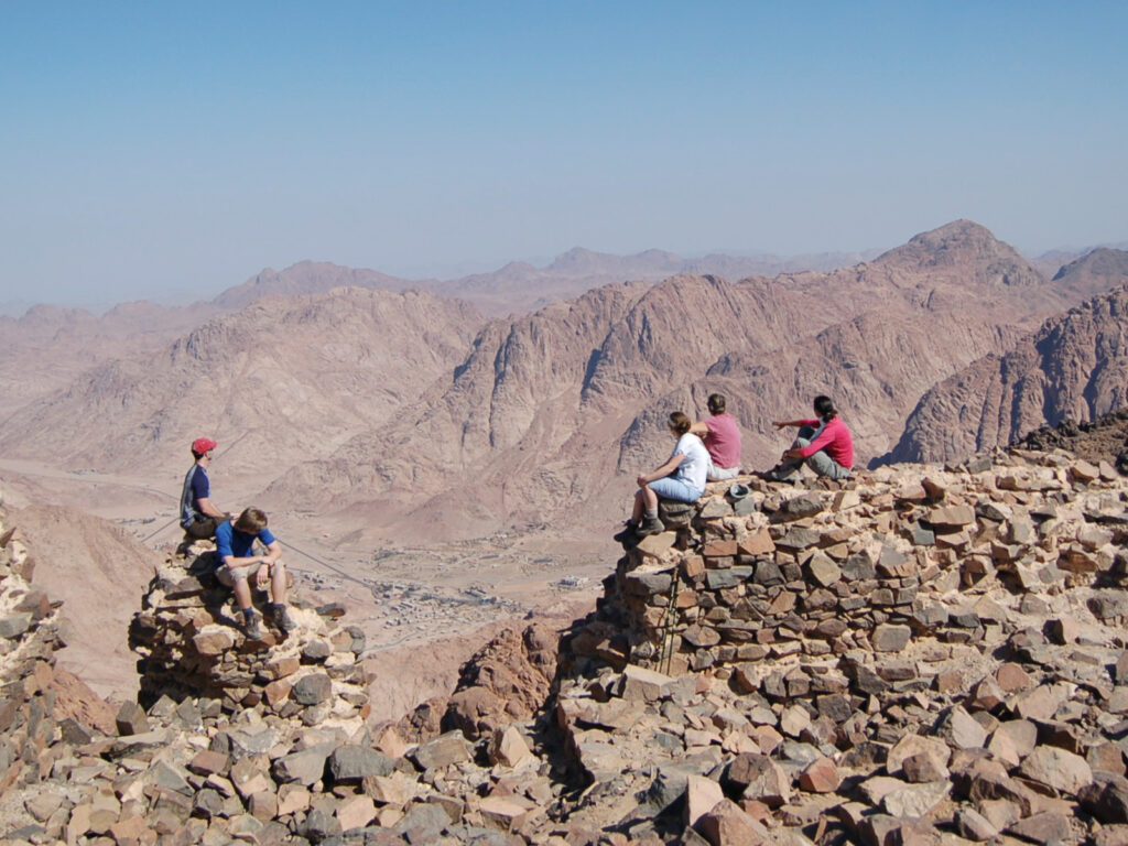
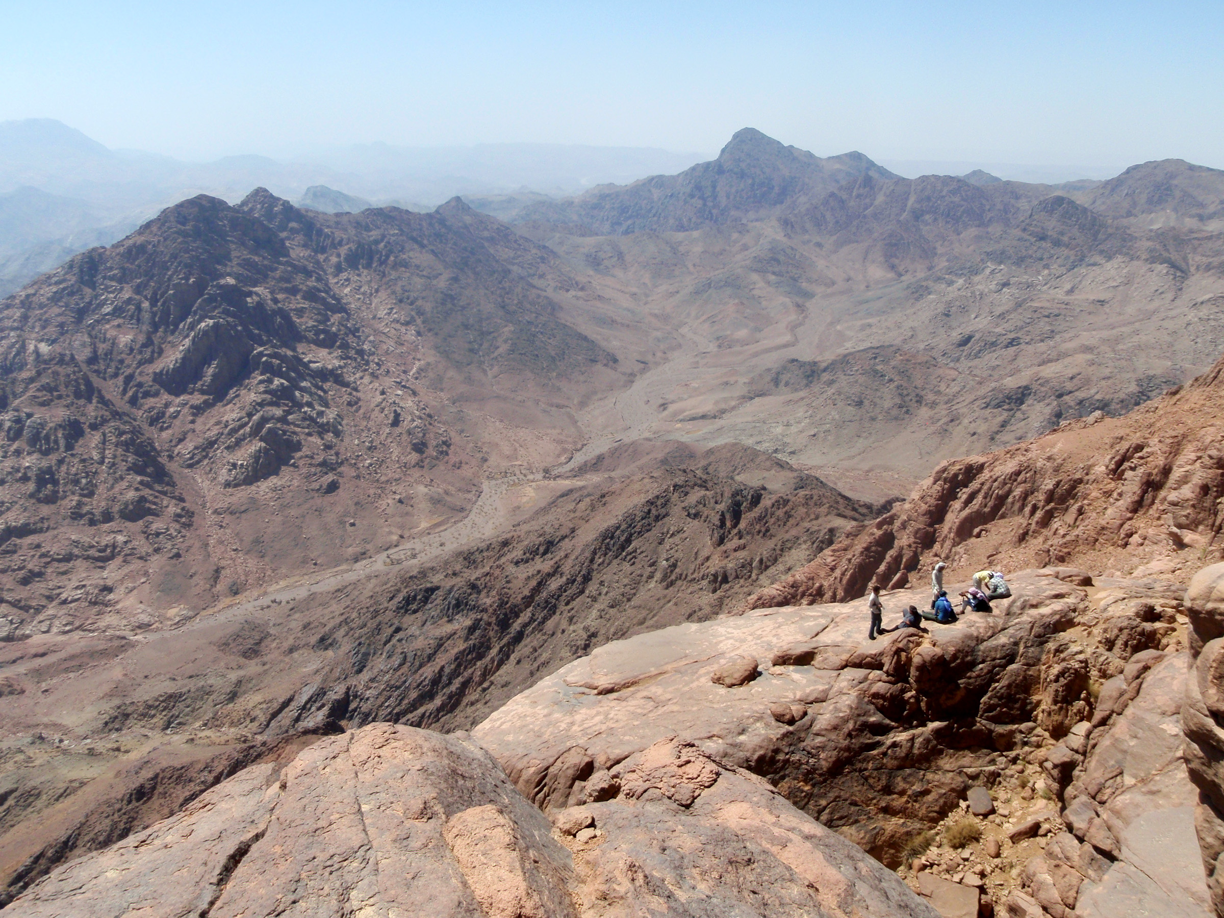
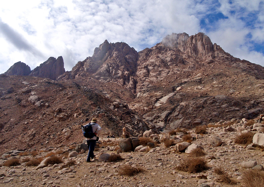
Mount Katharina is the highest mountain in Egypt at 2642 meters, with an Orthodox chapel on the summit. According to tradition this is the place where monks, after a dream, found the missing body of the martyred St.Katherina. Jebel Musa (Mt. Sinai) is right below, and the views onto it and the whole high mountain area are stunning. On most winter there is at least a little snow and the temperature can be chilly even on summer nights. Just below the chapel, there is a small shelter which hikers can use.
Jebel Ahmar
Jebel Ahmar is a big red dome of a single granite block with a smooth surface, standing next to Mount Katherina. The shortest route from Ramadan’s Garden in Wadi Arbain to the high mountan wadis is along the high pass of Wadi el Ahmar, avoiding the even higher Mout Katherine pass. People taking this route might visit Jebel el Ahmar itself, a short detour. From its rounded peak you get amazing views of the Wadi Raha plain and the surrounding mountain ranges.
Jebel Abbas Basha
Jebel Abbas Basha is located in the centre of the high mountains with stunning views all around, to the mountain ranges, the lowlands and to the town of St. Katherine with Mt. Sinai (Jebel Musa). The unfinished palace of Abbas Pasha is on top, its massive walls still stand firm. The best time to visit is either early in the morning or before sunset. Next to the black massif of Jebel Abbas Basha stands the massive red granite dome of Jebel Abu Mahashir. Hidden in it is the secluded green basin of Farsh Abu Mahshur. Climbing Jebel Abbas Basha is a moderate trek: steep climbs, but good path. However, reaching Farsh Abu Mahashur involves some scrambling and the path is a bit difficult.
Jebel Umm Loz
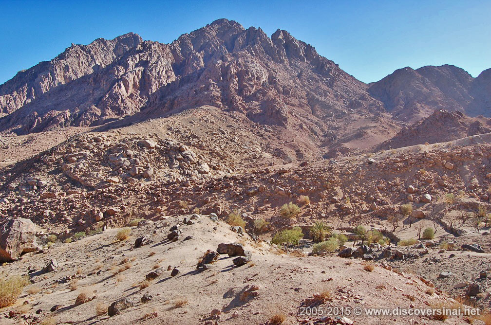
Standing in the center of the high mountains, above Wadi Bulia and Wadi Jibal, Jebel Umm Loz is also called “Ras el Jibal”, the “head of the mountains”. You get beautiful views of the surrounding mountains and wadis, but not as spectacular as other peaks on the perimeter of the high mountains massif, so it is rarely visited. It is still worth a mention, as apart from being amongst the tallest peaks, the red granite mountain is beautiful with little basins and relatively lush vegetation.
Ras Abu Alda & Masb Abu Gharun
Ras Abu Alda stands on the perimeter of the high mountains, south of Bab el-Donya of the same range, and hiking groups most often pass by on their way between Abu Ghasaba and Farsh Rummana. Standing on the edge of the high massif, there are stunning views on the lower ranges descending towards to coast of the Gulf of Suez. In clear weather, the coast and the coastal sandy plain, el Qaa, can be seen. Steps from the main trail, Masb Abu Gharun is a split rock hanging on the edge, resembling the horn of an Ibex – hence the name.
Bab el Donya (Jebel el Bab)
Bab el Donya and Jebel Bab are two peaks of a longer range, on the perimeter of the high mountains. To the east there are spectacular views of lower ranges running towards the Gulf of Suez and in clear weather you can see the sea. At the top there is a boulder stuck between the walls of a deep crack, a pretty sight and a tricky obstacle to climb. At the foot of Bab el Donya, there is the spring of Ein Najila where hiking groups most often take a rest before or after the climb.
Jebel Naja
Located on the perimeter of the high mountain mass in the north, reaching Jebel Naja is a tough walk. First you have to get up to the high mountain ranges, then the route continues from an area near the water pools of Kharazet el Shaq. As you approach Jebel Naja you are already high up, and the top of the mountain looks like a small hill from this side, but on the other side you feel the depth as you look down on the lowlands and the distant Tih Plateau. Jebel Naja stands above the junction of two major wadis, Wadi Jinab and Wadi Tala Kibira, marked with Sheikh Ahmed’s tomb, all which can be seen from some parts of the Jebel Naja summit.
Jebel el Banat
Standing on the northern perimeter of the high mountain massif, the peak of Jebel Banat offers superb views of the whole high mountains region on one side and the lowlands on the other, with Jebel Serbal and the Tih Plateau in the distance. It is a red granite mountain with several peaks that enclose a little basin. It is in the broader Wadi Freah area, just above the waterfall and pools of Sid al Nogra, reachable after a somewhat demanding and lengthy trek, either from Abu Zaituna, Abu Seila, or Sheikh Awad.
Low Wadis near Saint Catherine
There are a few lower wadis right around the town of Saint Catherine which are easy to visit separately, but they are part of the high mountain wadi system. Some of the treks to higher ground start of finish from them.
Wadi el Arbain (Wadi Leja)
Wadi el Arbain, also known as Wadi Leja, is along one of the routes to Mt. Sinai, but it is currently closed for visitors. It is also on the route to Mt. Katherina, Egypt’s highest peak, and home to the Monastery of the Forty Martyrs and the Rock of Moses. While at present access from town is not permitted, Wadi el Arbain is still important to mention for its important historic sites.
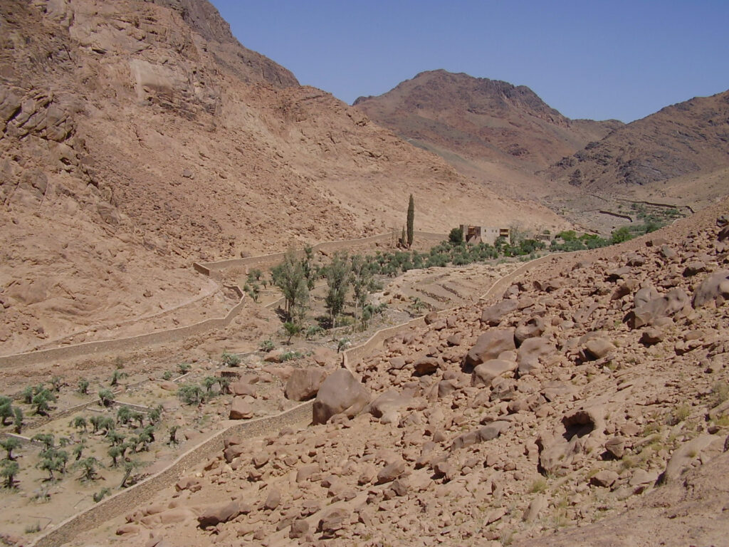
Wadi Tala
Wadi Tala is a beautiful wadi very near the town of St. Catherine, with a few gardens belonging to the Monastery and one to a Bedouin family. In the biggest garden there is a lesser known ancient Greek monastery named after Kosmas and Damianos. At the bottom of the wadi there is a spring at a deep cliff known as Ein Abu Tufaha. At the top of the wadi, a steep gully known as Sid Daud leads up to the high mountain wadis, the tricky path disappearing under a boulder at one point. A pass known as Naqg el Raheb connects Wadi Tala to town over a smaller granite range, and it is also approachable via Wadi Quweiz.
Wadi Itlah
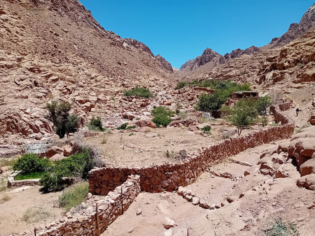
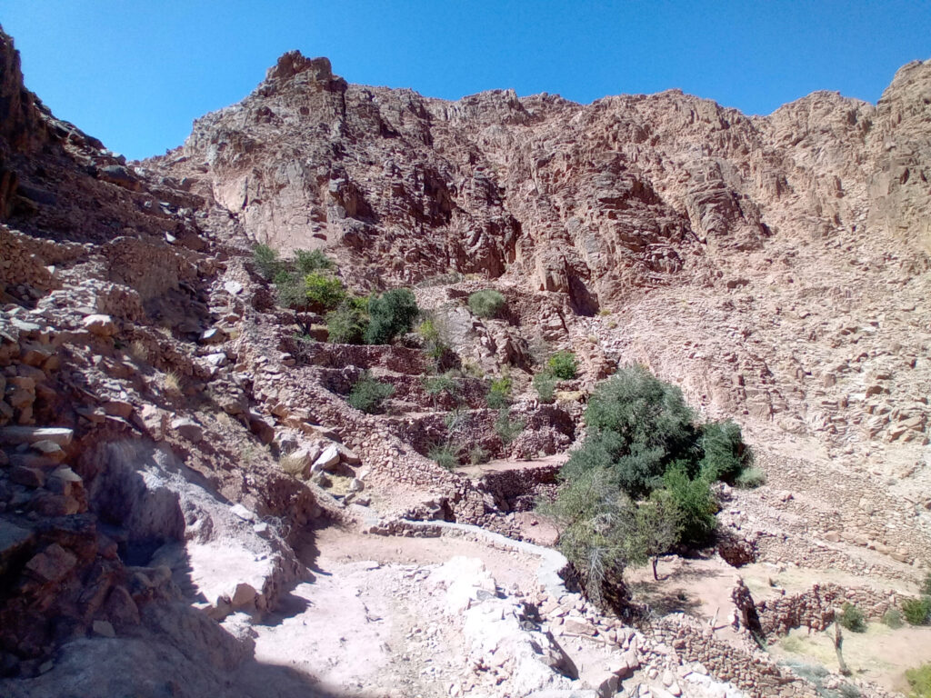
Wadi Itlah is the continuation downstream of short Wadi Quweiz coming from town and Wadi Tala which is connected to the high wadis via the gully of Sid Daud. Wadi Itlah, by this name, ends at the junction of Ubugiya and Wadi Shaq Tinya and continues as Wadi Jinab towards the plains near Sheikh Awad. Ubugiya is a small canyon connecting to the settlement of Abu Seila, while Wadi Shaq Tinya is also descending from the high mountain wadis. A huge boulder marks the start of Wadi Itlah shortly after the Wadi Quweiz and Wadi Tala junction, and there is a well-maintaned path in this upper part of the valley leading to Chapel of Saint John Klimakos. All along the wadi, there are many Bedouin gardens, several of them taking visitors.
Ubugiya
One of the ways between Wadi Itlah and the hamlet of Abu Seila, from where paved road leads back to the town of St Catherine, is via the little canyon known as Ubugiya. It’s short but picturesqe, especially after rains when water trickles in it through cascades and small pools. The path is tricky at some points, not suitable for everyone, but there is an alternative way over a pass known as Naqb Abu Seila. You can’t seriously hurt yourself in Ubugiya, but if you feel uncomfortable, you should stop and return and use the pass.
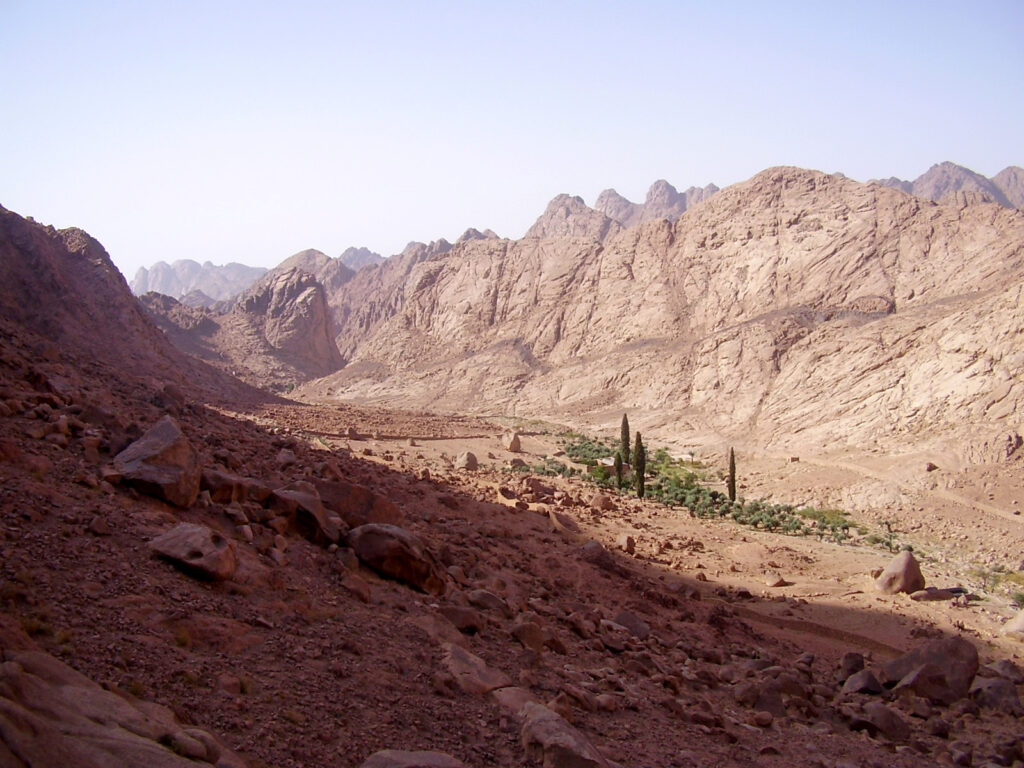
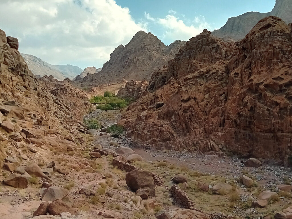
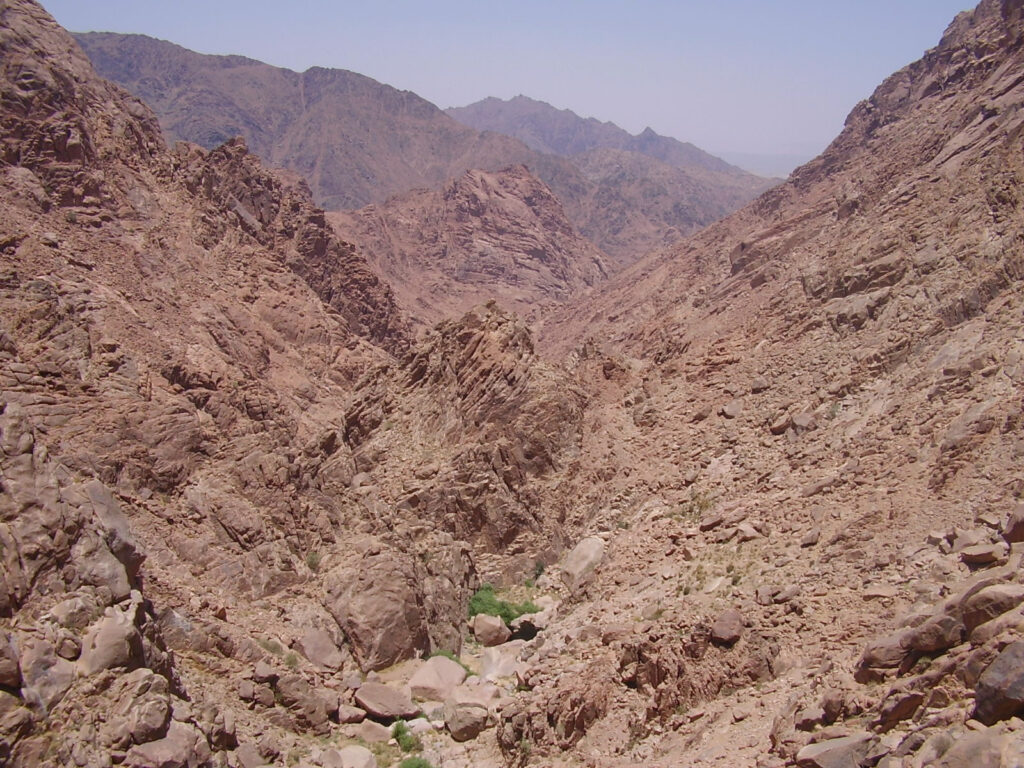
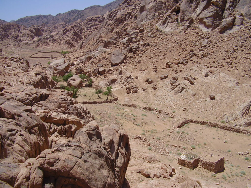
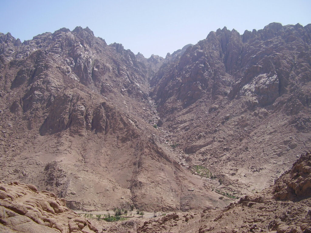
The High Wadis & Main Attractions
The wadis of the high mountains west and southwest of Saint Catherine form a complex labyrinth, with many beautiful Bedouin gardens, water pools and cascades, canyons, and most of the main attractions of the region. There are only a few access ways to this region from town, the most important are Abu Jeefa and Wadi Shaq Tinya.
Abu Jeefa
The steep and zigazagy Abu Jeefa is the main gateway to the high mountains, and the only one accessible for camels from Saint Catherine. You get beautiful views of town the further up you go, and there is already a terraced and stone-walled garden in this stretch. On the top there is a rest area under a shady bolder; few steps from it at the exact highest point, notice the ancient stone leopard trap. On the other side of the pass, the path descends into a location known as Islibet, and continues in Wadi Tubuq.
Sid Daud
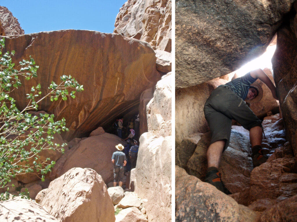
Sid Daud, meaning David’s Dam, is an alternative way to the high wadis between the upper end of Wadi Tala and the previously mentioned Islibet. It is a tricky way not suitble for everyone, although most people with little help can do it. Sid Daud is a steep gully with the path disappearing under huge boulders at points, where you have to climb through little holes. After rains, it may not be passable, but there is an alternative way around Sid Daud, known as Seru.
Wadi Tubuq
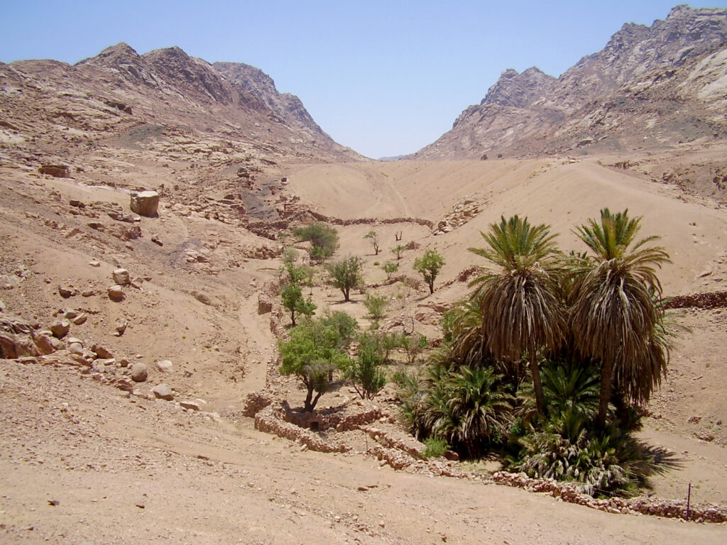
After the first few gardens in Islibet, the short but lush Wadi Tubuq is home to more Bedouin gardens, and you find the spring of Ein Skaya here and further up a mullberry tree, planted outside a garden. It is one of the dozen or so such trees found across the high mountains, always planted on public land and providing fruit to everyone.
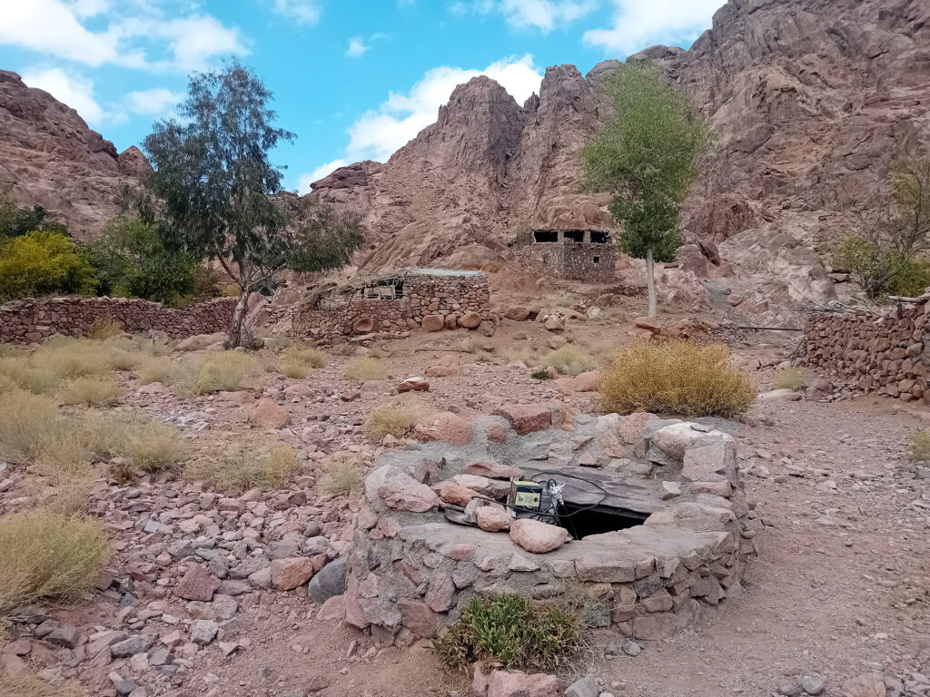
Ein Shkaya
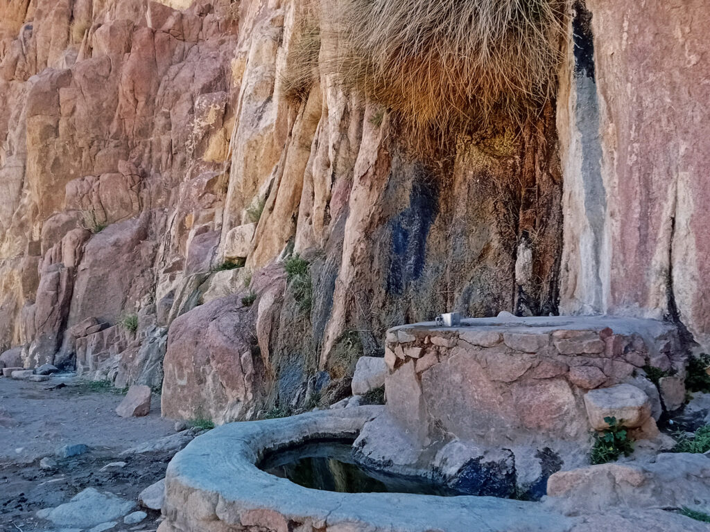
Ein Shakaya is a spring with water dripping from a crack in the rock wall. There are two fountains built at the spring, the lower for camels and other animals, the higher covered one for people. As all the water sources the Bedouin use in the mountains, it is safe to drink.
Wadi Shaq
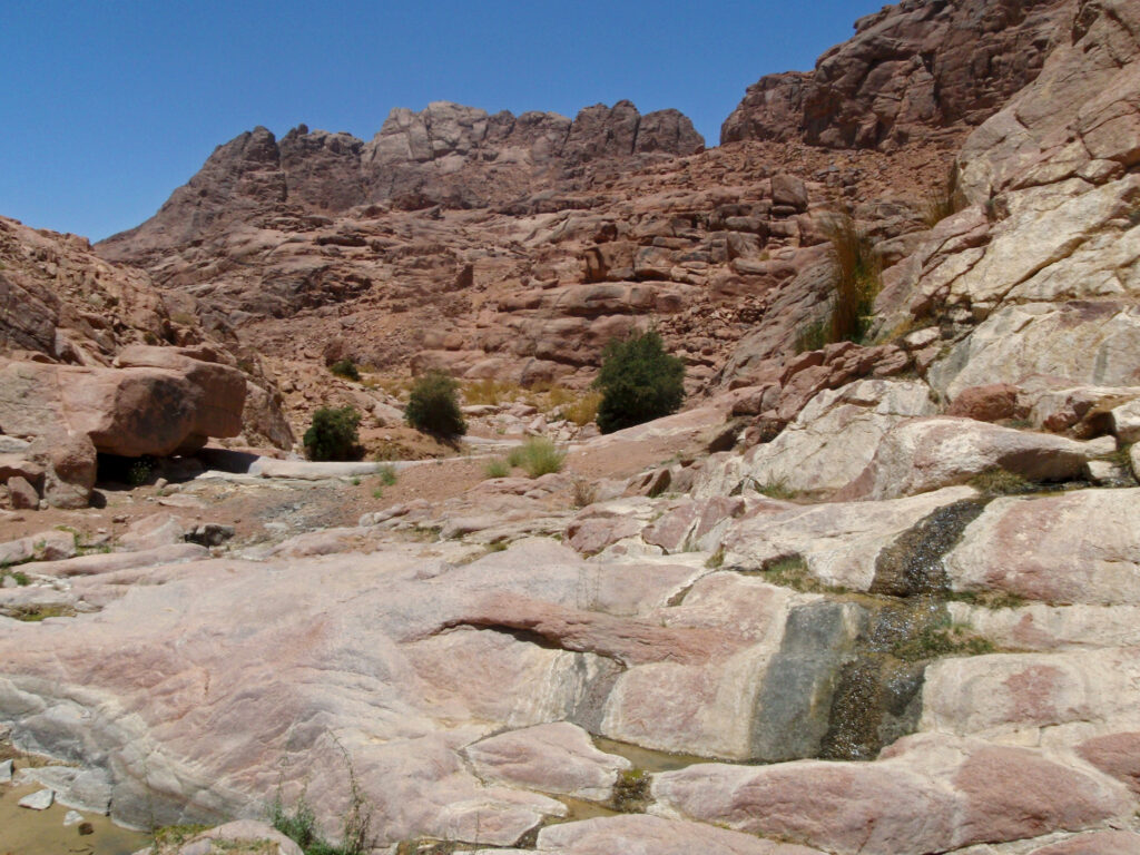
After Wadi Tubuq, there are two ways. One to Wadi Zawatin via El Ehded, the other to Wadi Shaq and beyond towards Mount Katherine. It is a narrow and short wadi where often water runs along the surface. In the lower part, there are big boulders and pools may form and passage may be not possible, but there is an upper path around it. At the top of the wadi is a single orchard, Ouda’s garden, next to tall palm trees. Further up through the wadi or over the hills, you can reach the water pool known as Kharaza.
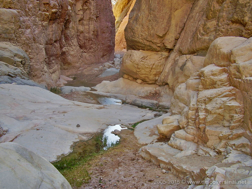
Kharaza
Kharaza is a series of connected water pools in a little canyon, between Wadi Shaq and Wadi Mathar. It drains water from the Mount Katherine range via Wadi al Ahmar, and often there is at least some in the pools. The main pool is at the canyon’s mouth down on the main wadi’s level, and you have to get up on the smooth rock face to reach the upper pool and enter the canyon. Further up the canyon opens up and connects to the main wadi nearer to Wadi Mathar.
Wadi Mathar
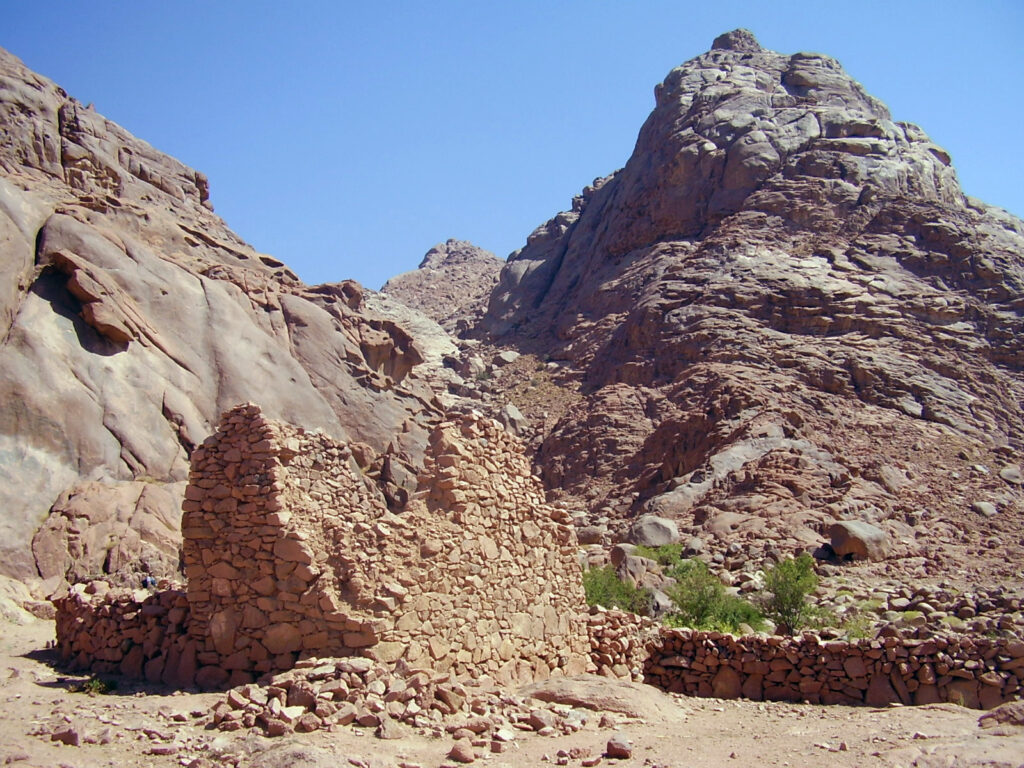
Either way you come from Wadi Shaq or from the opposite direction from Mount Katherine, the paths cross over the wide and open area known as Wadi Mathar. You find a few old, ruined, and abandoned gardens, but also some which are kept in beautiful condition. There is one next to another ancient for-the-public mullberry tree. There are also Byzantine ruins in the area, including a hermit cell. From here, there are trails to Mount Katherine, or back to the main wadis at El Ehded.
El Ehded & Wadi Zawatin
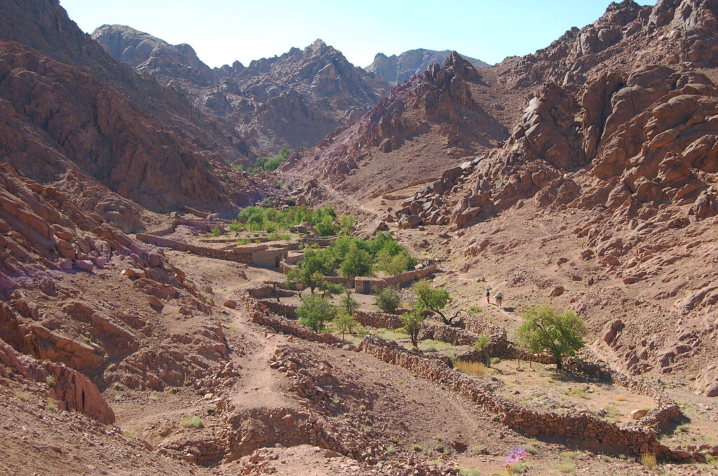
El Ehded is a short stretch of the main wadi of which Wadi Tubuq is part, but it can also be reached from Wadi Mathar and Wadi Shaq over a little pass. It is often mentined as Wadi Zawatin, which is another stretch a little further up. In El Ehded, there are only a couple of gardens, but in Wadi Zawatin quite a few connected as a puzzle. The area where the last gardens stand along the way to Jebel Abbas Basha is known as El Zirri. From Wadi Zawatin, the other main trail leads to Rehebit Nada and Wadi Jibal. Northworthy is the reservoire above Wadi Zawatin in a basin called Farsh Zaq.
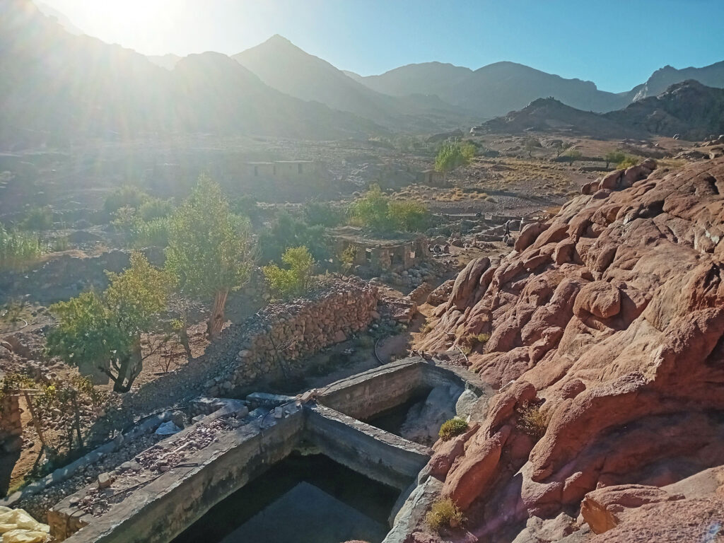
Farsh Zaq Reservoire
The dam in Farsh Zaq, located just above Wadi Zawatin, ofen retains some water in the basin even long after rains. There are several dams across the high mountains built by an organization, this is the most successful – and most beautiful – one. It is a short 5-10 minutes climb from the gardens, and it is also on the way to Farsh Abu Mahashur
Farsh Abu Mahashur
Farsh Abu Mahshur is not often visited as it is a difficult and at some points tricky climb, but it is a magnificent site. From here, you can continue to Jebel Abbas Basha without having to return to Wadi Zawatin and the main path, although it is a bit of a scramble over rough and slippery terrain. Farsh Abu Mahshur is a perfectly secluded basin in one massive granite mountain, Jebel Abu Mahashur, prominently seen from many locations of the area. After the narrow end of the basin, you can come out of the enclosed area to find yourself high above Wadi Zawatin, standing on the top of vertical granite walls. Jebel Abu Mahashur is one of the great mountains for serious rock climbers.
Rehebit Nada – Wadi Jibal top
Wadi Jibal is the name frequently used by local Bedouins to include the central areas of the High Mountain Region, not only this wadi. The wadi itself, one of the longest, runs more or less straight from Rehebit Nada, turning at an (perfct90) … angle at Abu Gassaba, and finishing at the open area of Farsh Rummana. Rehebit Nada is a big flat open area at the very top of the wadi, from Wadi Zawatin reachable over a steep zagzag pass. As the wadi descends,it gets narrower although still quite wide, with beautiful gardens along the way. At one point, another valley joins, it is Wadi Bulia.
Wadi Bulia
Wadi Bulia is a little and secluded wadi with a few gardens, under jebel Umm Loz, off the main path in Wadi Jibal. There is also a path from here to or from Jebel Abbas Basha via Farsh Dgemiyet and Sharafat el Iskikriya.
Abu Gasaba – Wadi Jibal turn
The straight stretch of Wadi Jibal comes to and end at Abu Gasaba, where it turns (perfect90) angle towards Farsh Rummana in different branches. There is another public mulberry tree here outside a garden, as well as the ruins of a Byzantine church. The location name suggests canes, which needs lot of water, and there is indeed a spring at the upper end of the garden next to the church. from this area, you can either head to Farsh Rummana, or climb the steep gully of Naqb Umm Siha on the way to Ras Abu Alda and Bab el Donya.
Frash Rummana – Wadi Jibal end
Farsh Rummana is a big open area, below the Jebel el Bab range, with the most direct route to the peak via Naqb Bahariya. A little downstream the wadi gets narrower and lusher, with a lot of canes and shallow seasonal pools under rocks in the area known as Tbeq, after which the wadi becomes very narrow and very steep, and known as Wadi Tala Kibira.
Ein Najila
Ein Najila is a spring just below the peaks of Bab el Donya and Jebel el Bab, with water cascading through a series of little water pools before disappearing in the sandy wadi floor. Downstream a little bit, there is the ruins of an ancient Byzantine church. Ein Najila is the main stop and resting place, either you’re coming from Abu Gasaba via Umm Siha and Ras Abu Alda, or from Farsh Rummana via Naqb Bahariya.
Wadi Tala el-Kibira
Wadi Tala Kibira is a long, narrow and steep wadi ending at Sheilh Ahmed, where Wadi Jinab, the other main water way from the high mountains, joins it and the two continue as Wadi Madaman to the plain at Sheikh Awad. There are two main paths in Wadi Tala Kibira, one high up in the steep sliopes of the wadi, the other down in the wadi floor. This latter is not always passable due to water, but then there are small detours around the obstacles. Attractions in Wadi Tala Kibira include Sid Abu Hbeq and the Canyon Beri, and further down the permanent water pool known as Galt el Azraq.
Sid Abu Hbeq & Canyon Beri
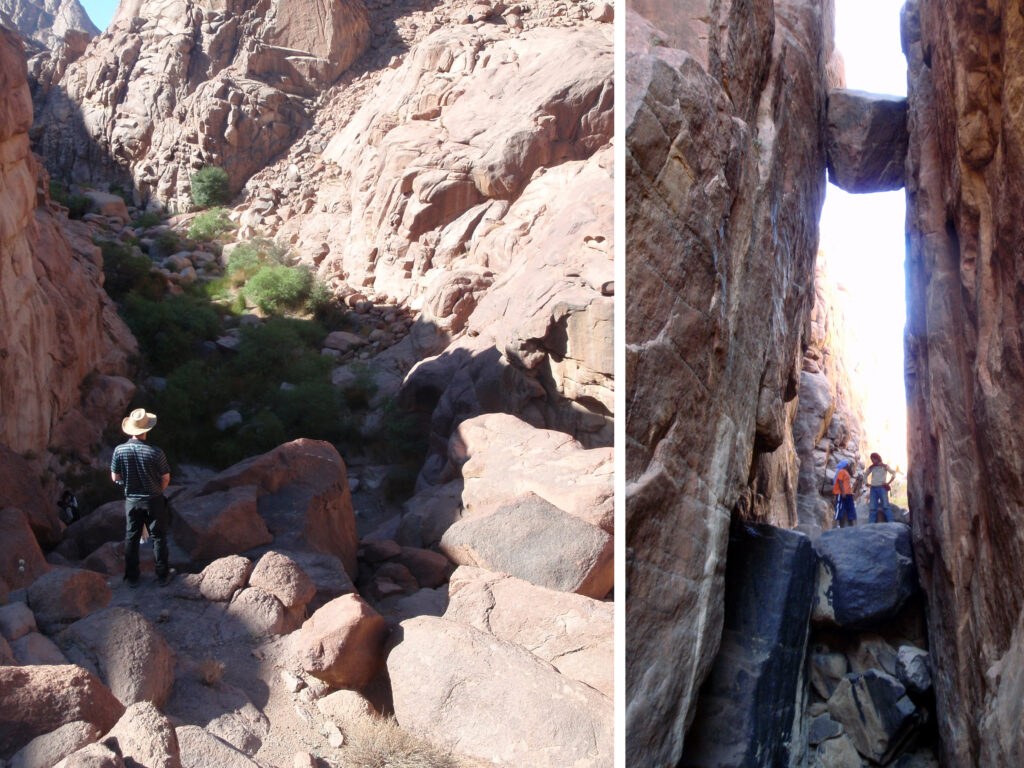
Sid Abu Hbeq is a bottleneck in Wadi Tala Kibira, with water and lush vegetation. In the name, ‘sid’ means dam, while ‘hbeq’ refers to the aromatic herb ‘habaq’ which needs a lot of water but grows here in abandunce. Canyon Beri, on the other side of the valley near Sid Abu Hbeq, is a short but tall canyon with a rock stuck between its vertical walls. One of the wadis from the Bab el Donya area ends here, joing Wadi Tala Kibira.
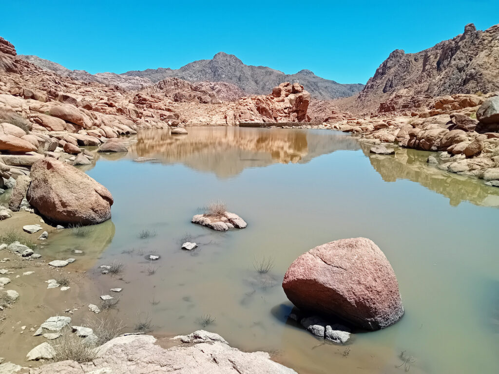
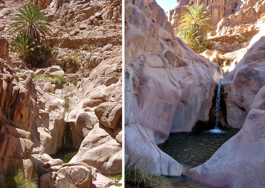
Galt el Azraq
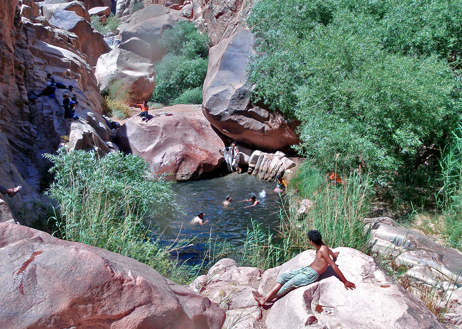
Galt el Azraq is the largest natural water pool in the High Mountain Region, and probably in the whole of South Sinai. It is full all year round, being fed by underground streams. It is also quite deep, providing in the hotter months the option of a refreshing dip. The name Galt el Azraq, despite azraq means blue in Arabic, actually means Black Pool in the Bedouin dialect: aswad, black in Arabic, is not used, possibly for negative connotations associated with it. From Galt el Azraq the main trail continues down towards Sheikh Ahmed, but it is rarely used by visitors who rather climb up a smal and steep path to the mountain top basin of Farsh Umm Silla, which then leads to Wadi Abu Tuweita and Wadi Tinya.
Wadi Tinya
Wadi Tinya is a long and wide valley skirting around the base of Jebel Abbas Basha, starting from the high saddle known as Sharafat el Iskikriya, and ending at the waterpools of Kharazet el Shaq, where it turns into Wadi Shaq Tinya that descends to low wadis. There are a few gardens along the wadi, but not as many and not as compact as other places. It is an important stretch for both the shorter and longer hiking circuits. A little detour leads to Wadi Abu Tuweita and Wadi Sagar, with latter being one of the stunning main attractions of the region. Jebel Naja is also approachable from Wadi Tinya, from its lower end.
Wadi Abu Tuweita
Wadi Abu Tiweita is a little wadi with mostly abandoned gardens, located above Wadi Tinya and connected to it either bay a pass or Wadi Sagar. Coming from Wadi Tinya it is a little detour, with the reason to make the extra walk is Wadi Sagar. Coming from Galt el Azraq, it is a convinient shortcut to Wadi Tinya, via Farsh Umm Silla. As you descend from the basin, there is another public mullberry tree.
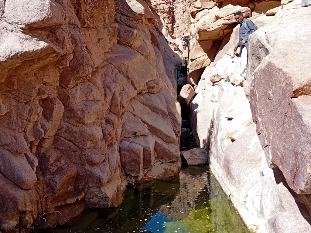
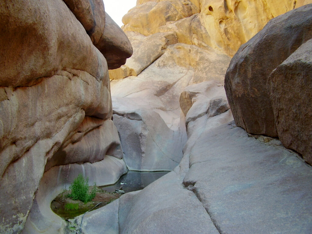
Wadi Sagar
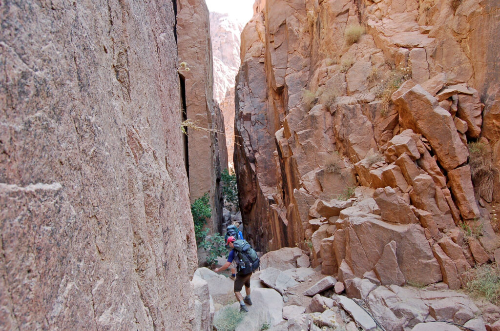
Wadi Sagar is a dramatic sight, a narrow crack in the granite massif that connects Wadi Abu Tuweita to the lower part of Wadi Tinya. It is an adventurous way, going through the canyon, involving scrambles and sliding down smooth rock surfaces. Wadi Sagar a bit further down opens up, before joining Wadi Tinya at a massive Bedouin garden.
Spring of Wadi Sagar
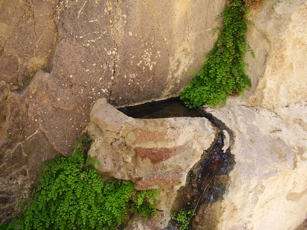
In the middle of the canyon part of Wadi Sagar, there is a spring, with a small fountain collecting water from a crack in the rock surface. It is safe to drink as large animals, such as feral donkeys, don’t get up here, but you should also keep it clean. According to custom, you should not dip your hand or bottle in the water, but use a cup to fill up your bottle (often provided next to it, but not always).
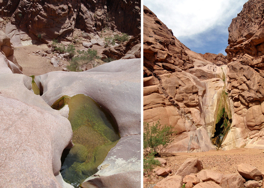
Kharazet el Shaq
One of the most beautiful sights in the high mountains is Kharazet el Shaq, a series of water pools and cascades, after the end of Wadi Tinya, at the top of the very steep and narrow Wadi Shaq Tinya. There is always some water in the main pools, and at times the overflowing water forms more pools and cascades. Above the pools there is a picnic area under palm trees; from here, you have to take a little pass over the rocky head to get to the bottom of the pools. You can go for a swim in the main pool here.
Wadi Shaq Tinya
Wadi Shagg Tinya is a long and steep gully connecting high-mountain wadis to lower Wadi Itlah. The whole Wadi Tinya area, including part of Gebel Abbas Basha, drains through this single gully. There are overflowing granite pools at the very top, Kharazet el Shaq, and there maybe other waterfalls and pools in the wadi at times. There are a few old gardens in the gully, built with massive walls to withstand the force of the occasional flash floods.The gully itself is a good 1-1.5 hours steep descent or ascent. Sometimes it is called Wadi Shaq Itlah, since it is where the gully descends to from the high wadis. At this junction in the bottom, Wadi Itlah joins and continues in Wadi Jinab towards Sheikh Awad.
The Wadi Freah Area
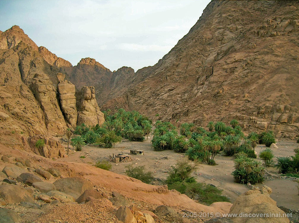
It is also part of the Sinai High Mountain Region but located north of the town, approachable from Abu Seila, Abu Zaituna, and Sheikh Awad. This area includes a a very large, open basin with little hills, surrounded by high peaks including Jebel Banat, and wadis with the waterfall of Sid al Nogra. Wadi Freah is just one wadi, the big open one coming from Abu Seila, but often the broader area is referred to as Wadi freah or Freah.
Wadi Freah
Wadi Freah proper is above the settlement of Abu Seila, accessible by a steep and farily high zigzag path. It is a very wide, quite flat, open wadi – more of a basin, really – that descends towards an area known as Bustan el Birka. There is only one Bedouin garden in the upper area, then a few more abandoned ones around and after Bustan el Birka.
Wadi Abu Zaituna
Coming from the settlement of Abu Zaituna, which is basically a suburb of Saint Catherine right on the main road, first you have to climb a short but steep pass to reach the top of Wadi Abu Zaituna. It is a long and wide wadi, but in the middle of it another narrow wadi runs between vertical walls below the main wadis surface. There are many Bedouin gardens in this area, but most are in a somewhat neglected state. This wadi also leads to the Bustan el Birka area, then continues on towards Wadi Nogra and Sid al Nogra.
Bustan el Birka
Bustan el Birka is the area where Wadi Freah and Wadi Abu Zaituna meet, it is a large and open basin with little hills and surrounded by distant ranges. The area got its name after the big garden here which used to have a big water tank, but the garden is now not looked after. There is a public mullberry tree here, too, outside of the garden. There are many Byzantine ruins in the area, which can be identified by certain traits. Your Bedouin guide should be able to point out some of these structures. The area drains to other wadis that lead to the waterfall of Sid al Nogra.
Wadi Nogra & Sid al Nogra
The waterfall of Sid al Nogra is a dramatic sight, although water only flows in it after winter rains. It is almost 40 meters high, and usually there is a little trickle of water in it and the granite pools at the top contain some water. It is located in Wadi Nogra, a narrow valley leading from the Bustan el Birka area to Wadi Gharba and then the settlement of Sheikh Awad.
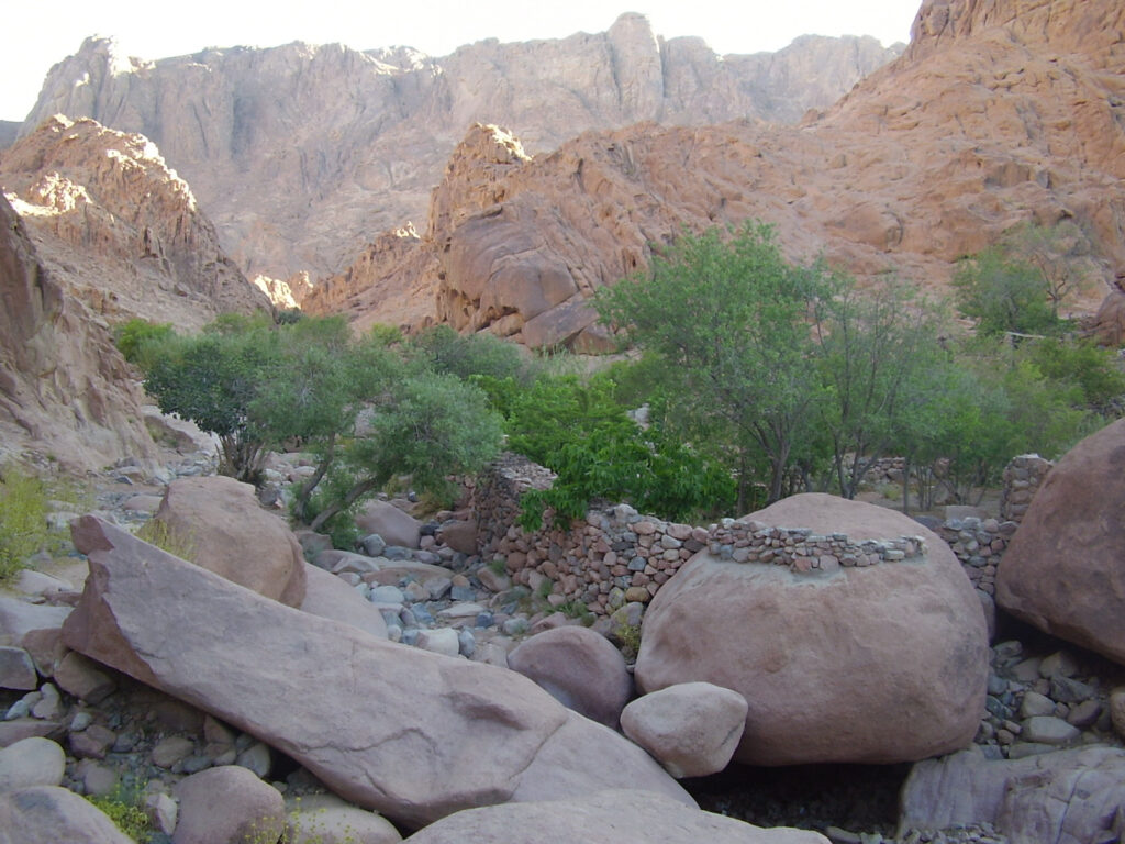
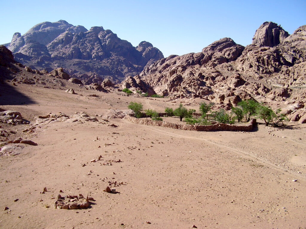
Sheikh Awad
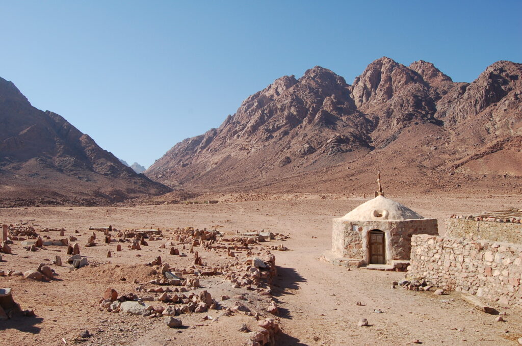
The settlement, named after the shrine of Sheikh Awad, is located at the foot of the high mountain massif where it meets the plains. The region’s first and most famous ecolodge, El Karm, is located in this settlement, in Wadi Gharba. Nearby, you can find the ruins of a Nabataean settlement. The main route to higher ground and the town of St. Catherine is via the Naqb el Hawa pass.
Naqb el Hawa
Naqb el Hawa was part of the major pilgrims route in the past, coming from Wadi Feiran over plains, and starting the ascent to the base of Mount Sinai from here. You can still see some of the original pavement made of big rocks at some places along the route. It is moderately steep but gradual and consistent, so in the end it is a fairly demanding ascent. There are a few gardens along the way, and a few more around the highest point, where the path reaches the settlement of Abu Seila.
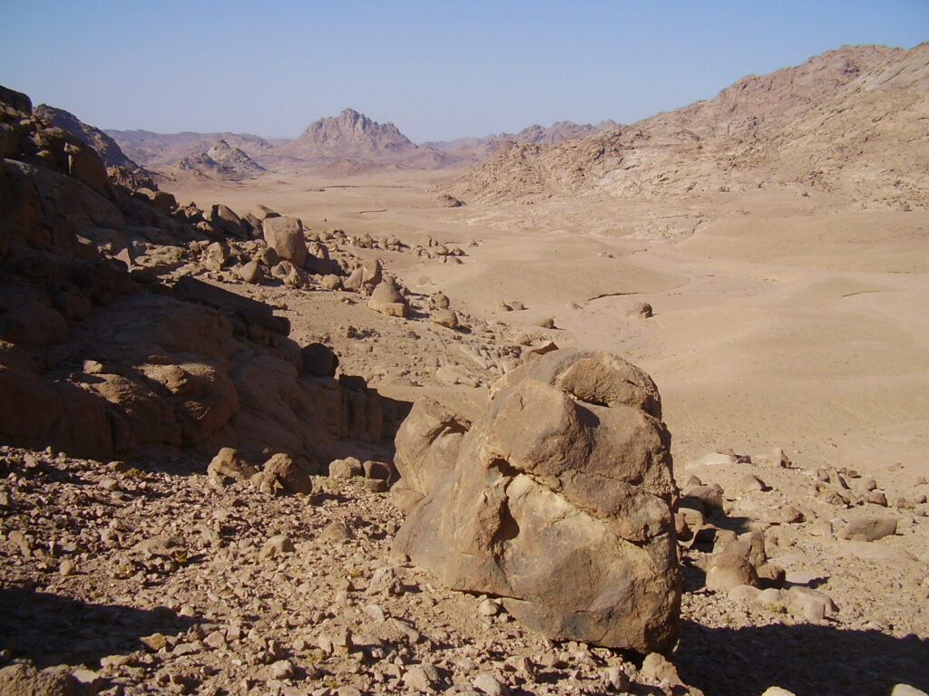
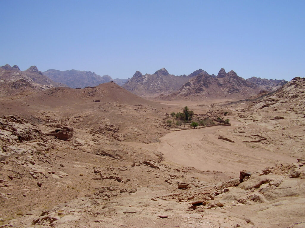
Remote High Mountains

As explained at the beginning of the page, the whole southern tip of the peninsula is a mountainous region, it is the remote high mountains. Northwest of St Catherine are Wadi Feiran and Jebel Serbal, west are Jebel Umm Shaumar, Wadi Rumhan, and Wadi Isla, and south are Ein Kid and Jebel Sabbah.
Wadi Feiran
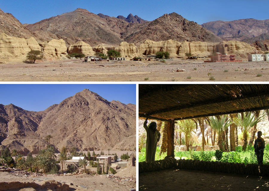
Wadi Feiran is the biggest oasis of South Sinai, running along the winding main road for 6 kilometers.There are important cultural and historical sites within the oasis, all located close to each other and to the commercial center. They include the Convent of Pharan (Deir el Banat), the ruins of the ancient Basilica, Jebel Tahouna, and many hermit caves. A couple of Bedouin gardens and the Convent of Feiran offer accommodation. The impressive Jebel Serbal massif dominates the view above the oasis.
Jebel Serbal
Although standing just a little above 2000 meters, but since it is surrounded by low wadis and smaller ranges, Jebel Serbal seems higher then any other mountain. The long and very steep gully of Naqb Shaharani might take a full day to cover. There are other routes as well leading to the interconnected basins and wadis at the top, which harbour gardens and permanent water sources, including Wadi Rim and Wadi Sigiliya. The views to the coast are as good as from Jebel Umm Shaumar.
Jebel Umm Shaumar
Jebel Umm Shaumar is the second highest mountain in Egypt, standing on the perimeter of the rugged mountainous interior, with long wadis and smaller ranges running towards the sandy plain and the coast at El Tur city. In clear weather you can see across the Gulf of Suez to mainland Egypt, to another continent: Africa.
Wadi Rumhan
Wadi Rumhan is along the ancient caravan route connecting the Saint Catherine area and the port city of El Tur. It starts at the foot of Jebel Umm Shaumar, where you also find the ruined Monastery of Rumhan. It is a narrow, winding, and long wadi without any major attraction, but is is a nice valley and important from a historical perspective.
Wadi Isla
Wadi Isla is the last stretch of the main caravan route connecting the center and the coast. The long and winding wadi is very narrow and lush towards the end, with many date palms, canes, tall grasses, trees and a creek running through a stunning gorge. The sight of the massive floodplain and the sea from the mouth of Wadi Isla is also very dramatic.
Jebel Sabbah
Jebel Sabbah is the southernmost high peak, located on the edge of the mountain range near the coastal plains. It is also the most remote, accessible through long winding wadis, and the climb itself is tough over difficult terrain. Not many people visit it, but for the record it is included here.
Ein Kid oasis
Ein Kid is a secluded and remote oasis between St. Catherine, Dahab and Sharm el Sheikh, with only a handful of Bedouin living there. Approachable only on foot from St. Catherine and via a one-way 4×4 track from the Sharm-Dahab road, it remains largely untouched and offers a feel of what a real oasis is used to be. Cars cannot drive all the way to the oasis, people have to walk about 10 minutes. There is not much to see and do in the oasis, apart from enjoying the setting and having a Bedouin tea, but that’s what gives its authenticity and character.
ATTRACTIONS: Red Sea Coast > St Catherine & Mt Sinai > The High Mountain Region > The Desert > North Sinai